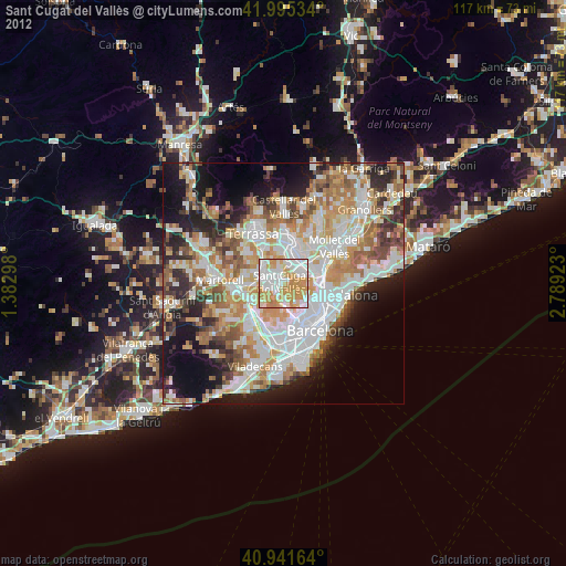
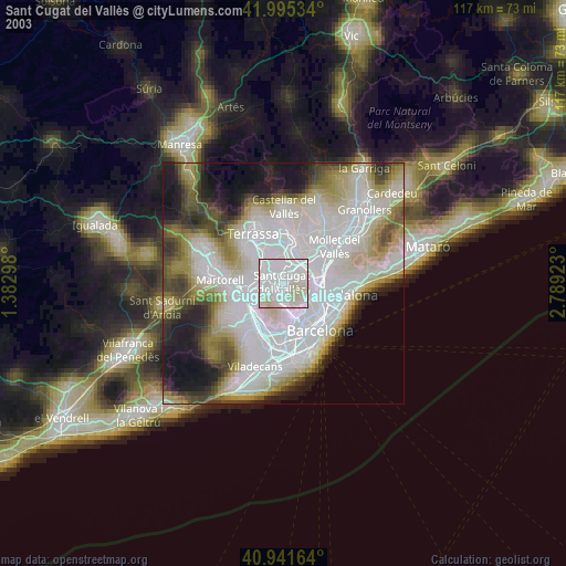
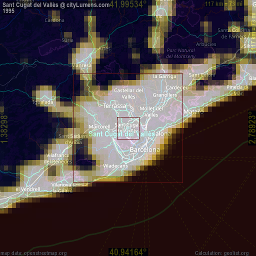
Sant Cugat del Vallès night lights from space
Night Light of Sant Cugat del Vallès (Catalonia) from space (Spain) Src. Average luminocity for 10x10km area is 82.6939% and for 50x50km: 48.8255%.
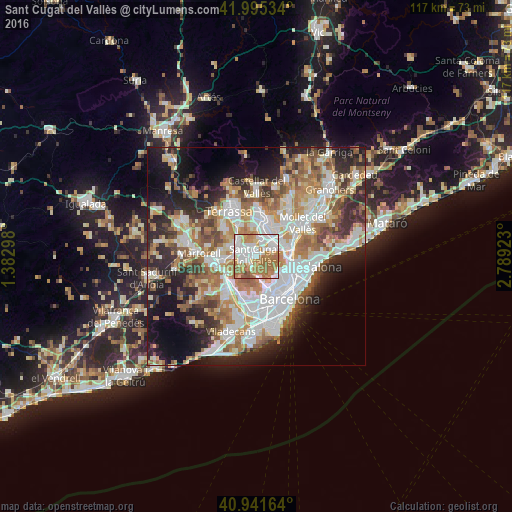
Analysis of Sant Cugat del Vallès night lights 2016
Square area 10x10 km:
 23.13%
90-99
23.3%80-89
7.65%70-79
12.93%60-69
27.72%50-59
4.59%40-49
0.68%30-39
0%20-29
0%10-19
0%0-9
0%Square area 50x50 km:
11.82%90-99
10.88%80-89
4.89%70-79
6.18%60-69
8.84%50-59
6.81%40-49
4.54%30-39
4.92%20-29
9.87%10-19
11.99%0-9
19.26%Clear (daylight) street map image can be seen on geolist.org.
Map coordinates:
41° 59' 43.2" North, 1° 22' 58.7" East
41° 28' 14.3" North, 2° 5' 10" East
40° 56' 29.9" North, 2° 47' 21.2" East
Some cities around Sant Cugat del Vallès sort by population:
• Rubí
5 km =3.1 mi,  298°
298°
• Cerdanyola del Vallès
5.1 km =3.2 mi,  63°
63°
• Ripollet
6.6 km =4.1 mi, 63°
• Barberà del Vallès
6 km =3.7 mi,  32°
32°
• Horta
7.1 km =4.4 mi,  122°
122°
• Canyelles
7 km =4.3 mi,  113°
113°
• la Vall d'Hebron
6.8 km =4.2 mi,  130°
130°
• Montbau
5.8 km =3.6 mi, 132°
3110718 (p: 79,253)
Sources (retrieved 2019-11-25):
» NASA, Earths city lights 1995
» NASA city lights 2003
» Earth at Night: Flat Maps 2012, 2016