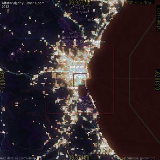
Alfafar night lights from space
Night Light of Alfafar (Valencia) from space (Spain) Src. Average luminocity for 10x10km area is 77.1071% and for 50x50km: 29.6231%.
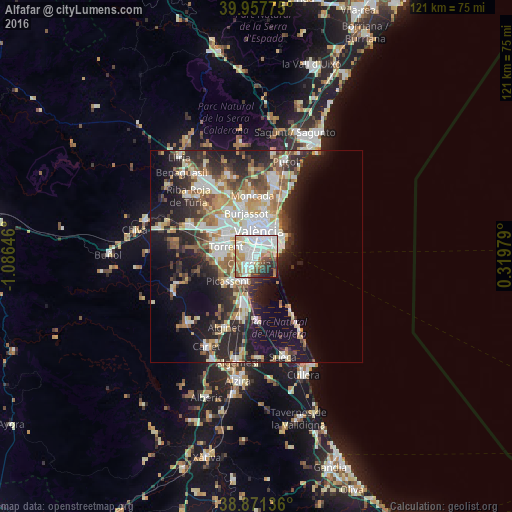
Analysis of Alfafar night lights 2016
Square area 10x10 km:
100  25.68%
90-99 24.49%
80-89 7.65%
70-79 7.31%
60-69 10.54%
50-59 4.76%
40-49 6.63%
30-39 4.93%
20-29 6.29%
10-19 1.7%
0-9 0%
25.68%90-99
24.49%80-89
7.65%70-79
7.31%60-69
10.54%50-59
4.76%40-49
6.63%30-39
4.93%20-29
6.29%10-19
1.7%0-9
0%Square area 50x50 km:
100 5.96%
90-99 6%
80-89 3.28%
70-79 3.65%
60-69 3.96%
50-59 3.45%
40-49 3.44%
30-39 4.24%
20-29 9.12%
10-19 13.62%
0-9 43.3%
5.96%90-99
6%80-89
3.28%70-79
3.65%60-69
3.96%50-59
3.45%40-49
3.44%30-39
4.24%20-29
9.12%10-19
13.62%0-9
43.3%Clear (daylight) street map image can be seen on geolist.org.
Map coordinates:
39° 57' 27.9" North, 1° 5' 11.3" West
39° 25' 0" North, 0° 22' 60" West
38° 52' 16.9" North, 0° 19' 11.2" East
Some cities around Alfafar sort by population:
• Valencia
5.9 km =3.7 mi,  4°
4°
• Catarroja
2.3 km =1.4 mi,  217°
217°
• Paiporta
3.2 km =2 mi,  293°
293°
• Silla
6.5 km =4 mi,  202°
202°
• Albal
3.4 km =2.1 mi,  237°
237°
• Benetússer
1.3 km =0.8 mi,  299°
299°
• Picanya
4.7 km =2.9 mi, 293°
• Sedaví
1.9 km =1.2 mi, 0°
2522057 (p: 20,853)
Sources (retrieved 2019-11-25):
» Earth at Night: Flat Maps 2012, 2016