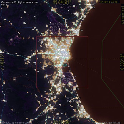
Catarroja night lights from space
Night Light of Catarroja (Valencia) from space (Spain) Src. Average luminocity for 10x10km area is 71.6888% and for 50x50km: 29.5808%.
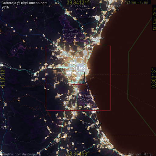
Analysis of Catarroja night lights 2016
Square area 10x10 km:
100  19.56%
90-99 21.09%
80-89 7.99%
70-79 7.99%
60-69 13.1%
50-59 6.63%
40-49 6.29%
30-39 5.44%
20-29 7.48%
10-19 4.42%
0-9 0%
19.56%90-99
21.09%80-89
7.99%70-79
7.99%60-69
13.1%50-59
6.63%40-49
6.29%30-39
5.44%20-29
7.48%10-19
4.42%0-9
0%Square area 50x50 km:
100 5.96%
90-99 5.98%
80-89 3.33%
70-79 3.64%
60-69 4.03%
50-59 3.43%
40-49 3.33%
30-39 4.27%
20-29 8.7%
10-19 13.7%
0-9 43.63%
5.96%90-99
5.98%80-89
3.33%70-79
3.64%60-69
4.03%50-59
3.43%40-49
3.33%30-39
4.27%20-29
8.7%10-19
13.7%0-9
43.63%Clear (daylight) street map image can be seen on geolist.org.
Map coordinates:
39° 56' 28.4" North, 1° 6' 11.3" West
39° 24' 0" North, 0° 24' 0" West
38° 51' 16.4" North, 0° 18' 11.3" East
Some cities around Catarroja sort by population:
• Paiporta
3.5 km =2.2 mi,  334°
334°
• Alfafar
2.3 km =1.4 mi,  37°
37°
• Silla
4.3 km =2.7 mi,  193°
193°
• Albal
1.4 km =0.9 mi,  270°
270°
• Benetússer
2.5 km =1.6 mi,  6°
6°
• Picanya
4.7 km =2.9 mi,  322°
322°
• Sedaví
4 km =2.5 mi,  21°
21°
• Alcàsser
5.2 km =3.2 mi,  226°
226°
2519690 (p: 27,035)
Sources (retrieved 2019-11-25):
» Earth at Night: Flat Maps 2012, 2016