Paiporta night lights from space
Night Light of Paiporta (Valencia) from space (Spain) Src. Average luminocity for 10x10km area is 86.5646% and for 50x50km: 30.2119%.
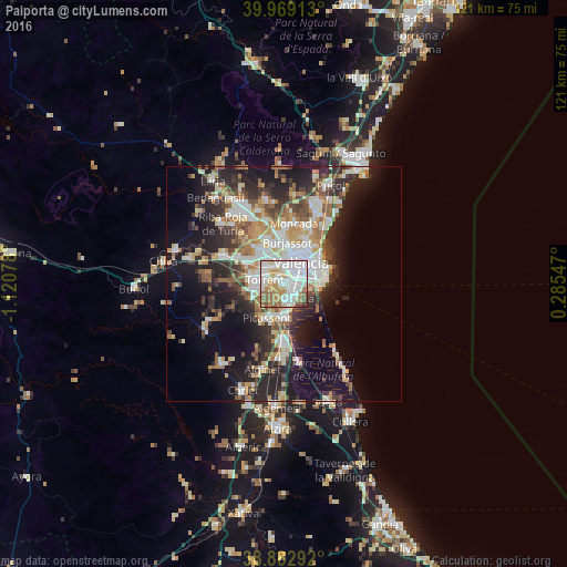
Analysis of Paiporta night lights 2016
Square area 10x10 km:
100  30.27%
90-99 30.95%
80-89 9.35%
70-79 8.33%
60-69 12.41%
50-59 5.27%
40-49 2.55%
30-39 0.68%
20-29 0.17%
10-19 0%
0-9 0%
30.27%90-99
30.95%80-89
9.35%70-79
8.33%60-69
12.41%50-59
5.27%40-49
2.55%30-39
0.68%20-29
0.17%10-19
0%0-9
0%Square area 50x50 km:
100 5.98%
90-99 6.02%
80-89 3.28%
70-79 3.74%
60-69 4.2%
50-59 3.6%
40-49 3.49%
30-39 4.25%
20-29 9.28%
10-19 14.36%
0-9 41.82%
5.98%90-99
6.02%80-89
3.28%70-79
3.74%60-69
4.2%50-59
3.6%40-49
3.49%30-39
4.25%20-29
9.28%10-19
14.36%0-9
41.82%Clear (daylight) street map image can be seen on geolist.org.
Map coordinates:
39° 58' 8.9" North, 1° 7' 14.8" West
39° 25' 41.3" North, 0° 25' 3.5" West
38° 52' 58.5" North, 0° 17' 7.7" East
Some cities around Paiporta sort by population:
• Torrent
4.2 km =2.6 mi,  283°
283°
• Xirivella
4.3 km =2.7 mi,  350°
350°
• Catarroja
3.5 km =2.2 mi,  154°
154°
• Alfafar
3.2 km =2 mi,  113°
113°
• Albal
3.1 km =1.9 mi,  178°
178°
• Benetússer
1.9 km =1.2 mi, 108°
• Picanya
1.5 km =0.9 mi,  293°
293°
• Sedaví
3 km =1.9 mi,  78°
78°
2513029 (p: 23,519)
Sources (retrieved 2019-11-25):
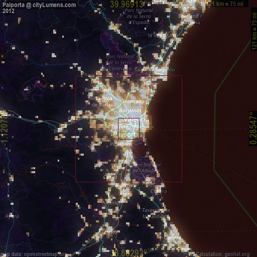
» Earth at Night: Flat Maps 2012, 2016