Maardu night lights from space
Night Light of Maardu (Harjumaa) from space (Estonia) Src. Average luminocity for 10x10km area is 52.3787% and for 50x50km: 13.0957%.
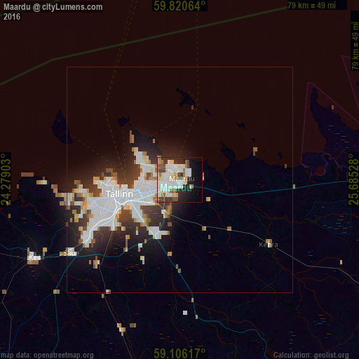
Analysis of Maardu night lights 2016
Square area 10x10 km:
 14.63%
90-99
14.85%80-89
7.82%70-79
2.49%60-69
5.33%50-59
5.9%40-49
3.17%30-39
4.76%20-29
9.98%10-19
12.36%0-9
18.71%Square area 50x50 km:
3.68%90-99
3.43%80-89
1.15%70-79
0.75%60-69
1.04%50-59
0.95%40-49
1.26%30-39
2.02%20-29
3.55%10-19
5.86%0-9
76.31%Clear (daylight) street map image can be seen on geolist.org.
Map coordinates:
59° 49' 14.3" North, 24° 16' 44.5" East
59° 27' 55" North, 24° 58' 55.7" East
59° 6' 22.2" North, 25° 41' 7" East
Some cities around Maardu sort by population:
• Tallinn
13.3 km =8.3 mi,  256°
256°
• Lauttasaari, FI
77.4 km =48.1 mi,  355°
355°
• Paide
72.3 km =44.9 mi,  153°
153°
• Keila
36.9 km =22.9 mi,  240°
240°
• Tapa
59.8 km =37.2 mi,  112°
112°
• Türi
77.4 km =48.1 mi,  160°
160°
• Rapla
52.1 km =32.4 mi,  191°
191°
• Saue
29.2 km =18.1 mi, 237°
590447 (p: 16,630)
Sources (retrieved 2019-11-25):
» Earth at Night: Flat Maps 2012, 2016