Tallinn night lights from space
Night Light of Tallinn (Harjumaa) from space (Estonia) Src. Average luminocity for 10x10km area is 82.1483% and for 50x50km: 13.8631%.
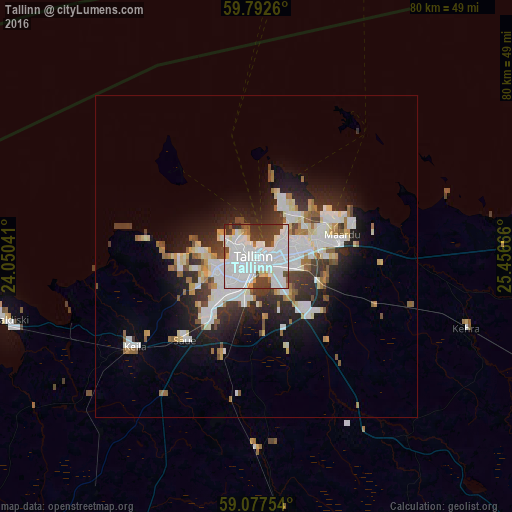

Analysis of Tallinn night lights 2016
Square area 10x10 km:
 39.72%
90-99
28.46%80-89
2.38%70-79
2.81%60-69
1.62%50-59
1.84%40-49
7.9%30-39
11.04%20-29
4.22%10-19
0%0-9
0%Square area 50x50 km:
3.73%90-99
3.49%80-89
1.19%70-79
0.83%60-69
1.3%50-59
1.07%40-49
1.29%30-39
2.13%20-29
3.52%10-19
6.28%0-9
75.17%Clear (daylight) street map image can be seen on geolist.org.
Map coordinates:
59° 47' 33.4" North, 24° 3' 1.5" East
59° 26' 13.1" North, 24° 45' 12.7" East
59° 4' 39.1" North, 25° 27' 24" East
Some cities around Tallinn sort by population:
• Kirkkonummi, FI
78.4 km =48.7 mi,  347°
347°
• Maardu
13.3 km =8.3 mi,  76°
76°
• Paide
76.5 km =47.5 mi,  143°
143°
• Keila
24.3 km =15.1 mi,  232°
232°
• Tapa
71.1 km =44.2 mi,  106°
106°
• Rapla
47.8 km =29.7 mi,  177°
177°
• Ingå, FI
79.7 km =49.5 mi,  328°
328°
• Saue
17.2 km =10.7 mi,  222°
222°
588409 (p: 394,024)
Sources (retrieved 2019-11-25):
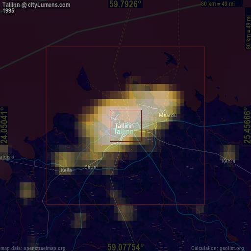
» NASA, Earths city lights 1995
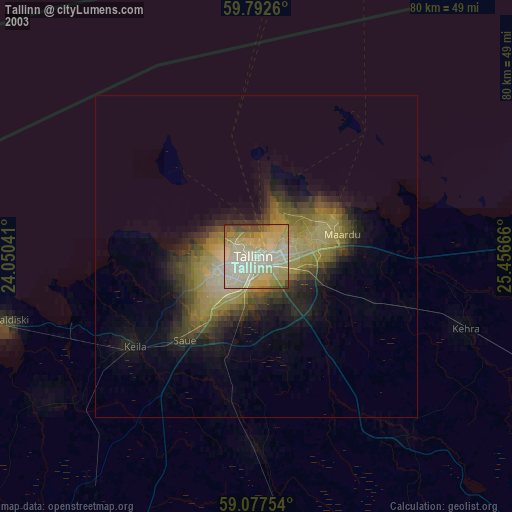
» NASA city lights 2003
» Earth at Night: Flat Maps 2012, 2016