Keila night lights from space
Night Light of Keila (Harjumaa) from space (Estonia) Src. Average luminocity for 10x10km area is 8.5758% and for 50x50km: 10.0367%.
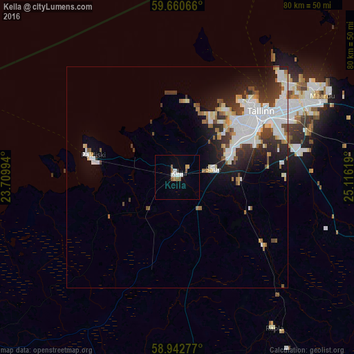
Analysis of Keila night lights 2016
Square area 10x10 km:
100  1.62%
1.62%
90-99 1.84%
80-89 0%
70-79 1.3%
60-69 0.54%
50-59 2.49%
40-49 0%
30-39 0.43%
20-29 0%
10-19 0.43%
0-9 91.34%
1.62%90-99
1.84%80-89
0%70-79
1.3%60-69
0.54%50-59
2.49%40-49
0%30-39
0.43%20-29
0%10-19
0.43%0-9
91.34%Square area 50x50 km:
100 2.85%
90-99 2.54%
80-89 0.81%
70-79 0.66%
60-69 0.79%
50-59 0.75%
40-49 0.97%
30-39 1.55%
20-29 2.26%
10-19 3.91%
0-9 82.91%
2.85%90-99
2.54%80-89
0.81%70-79
0.66%60-69
0.79%50-59
0.75%40-49
0.97%30-39
1.55%20-29
2.26%10-19
3.91%0-9
82.91%Clear (daylight) street map image can be seen on geolist.org.
Map coordinates:
59° 39' 38.4" North, 23° 42' 35.8" East
59° 18' 13" North, 24° 24' 47" East
58° 56' 34" North, 25° 6' 58.3" East
Some cities around Keila sort by population:
• Tallinn
24.3 km =15.1 mi,  52°
52°
• Maardu
36.9 km =22.9 mi,  60°
60°
• Haapsalu
63.9 km =39.7 mi,  231°
231°
• Paide
80.2 km =49.8 mi,  125°
125°
• Türi
80.2 km =49.8 mi, 133°
• Rapla
39.4 km =24.5 mi,  146°
146°
• Ingå, FI
85.7 km =53.3 mi,  344°
344°
• Saue
8 km =5 mi,  74°
74°
591472 (p: 9,411)
Sources (retrieved 2019-11-25):
» Earth at Night: Flat Maps 2012, 2016