La Libertad night lights from space
Night Light of La Libertad (Guayas) from space (Ecuador) Src. Average luminocity for 10x10km area is 69.2381% and for 50x50km: 9.8551%.
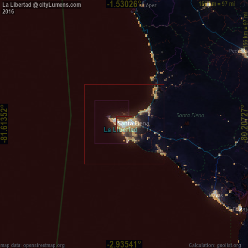
Analysis of La Libertad night lights 2016
Square area 10x10 km:
 16.88%
90-99
19.48%80-89
8.44%70-79
15.15%60-69
5.63%50-59
4.11%40-49
4.33%30-39
8.66%20-29
16.88%10-19
0.43%0-9
0%Square area 50x50 km:
0.83%90-99
1.04%80-89
1.89%70-79
2.06%60-69
1.06%50-59
0.71%40-49
1.51%30-39
2.1%20-29
2.69%10-19
6.27%0-9
79.85%Clear (daylight) street map image can be seen on geolist.org.
Map coordinates:
1° 31' 48.9" South, 81° 36' 48.7" West
2° 13' 58.8" South, 80° 54' 37.4" West
2° 56' 7.5" South, 80° 12' 26.2" West
Some cities around La Libertad sort by population:
• Salinas
5 km =3.1 mi,  294°
294°
• Santa Elena
5.8 km =3.6 mi,  82°
82°
• Jipijapa
105 km =65.2 mi,  20°
20°
• Playas
73 km =45.4 mi,  127°
127°
• Pedro Carbo
88.4 km =54.9 mi,  58°
58°
• Santa Lucía
101.3 km =62.9 mi,  86°
86°
• Paján
92.6 km =57.5 mi,  35°
35°
• Lomas de Sargentillo
99.8 km =62 mi,  67°
67°
3655131 (p: 75,881)
Sources (retrieved 2019-11-25):
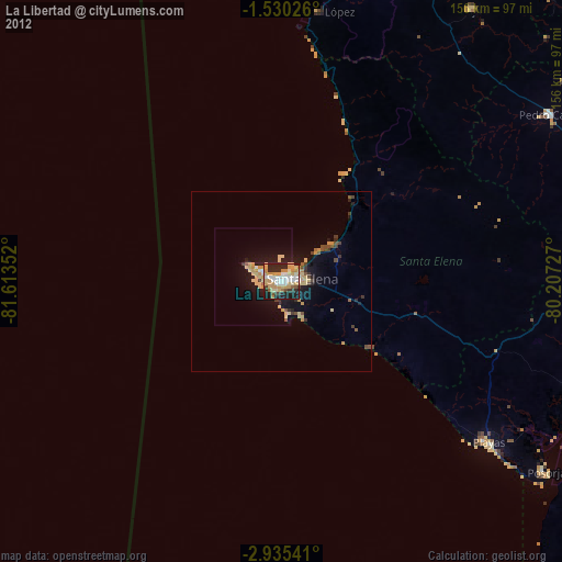
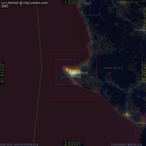
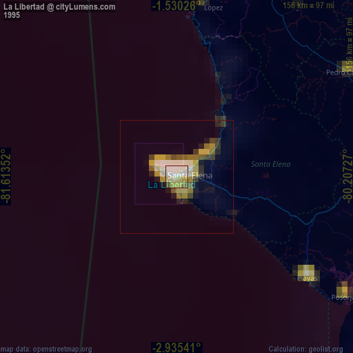
» NASA, Earths city lights 1995
» NASA city lights 2003
» Earth at Night: Flat Maps 2012, 2016