Debila night lights from space
Night Light of Debila (El Oued) from space (Algeria) Src. Average luminocity for 10x10km area is 47.8681% and for 50x50km: 13.5058%.
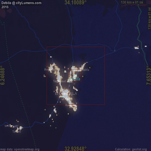
Analysis of Debila night lights 2016
Square area 10x10 km:
 6.96%
6.96%90-99
17.03%80-89
4.4%70-79
5.31%60-69
5.49%50-59
0.73%40-49
4.21%30-39
10.44%20-29
18.68%10-19
17.77%0-9
8.97%Square area 50x50 km:
1.78%90-99
3.67%80-89
1.64%70-79
1%60-69
1.03%50-59
0.93%40-49
1.29%30-39
1.75%20-29
6.59%10-19
11.02%0-9
69.3%Clear (daylight) street map image can be seen on geolist.org.
Map coordinates:
34° 6' 3.2" North, 6° 14' 48.8" East
33° 31' 0" North, 6° 57' 0" East
32° 55' 42.5" North, 7° 39' 11.3" East
Some cities around Debila sort by population:
• El Oued
19.6 km =12.2 mi,  204°
204°
• Reguiba
23.5 km =14.6 mi,  282°
282°
• Djamaa
88.7 km =55.1 mi,  271°
271°
• Tebesbest
92 km =57.2 mi,  241°
241°
• Megarine
87.9 km =54.6 mi,  245°
245°
• Robbah
26.6 km =16.5 mi,  188°
188°
• Sidi Amrane
87.4 km =54.3 mi, 268°
• Taïbet
70.8 km =44 mi,  227°
227°
2500737 (p: 36,834)
Sources (retrieved 2019-11-25):
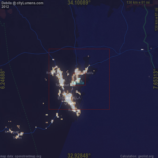
» Earth at Night: Flat Maps 2012, 2016