Veragua Arriba night lights from space
Night Light of Veragua Arriba (Espaillat) from space (Dominican Republic) Src. Average luminocity for 10x10km area is 0.0558% and for 50x50km: 4.0941%.
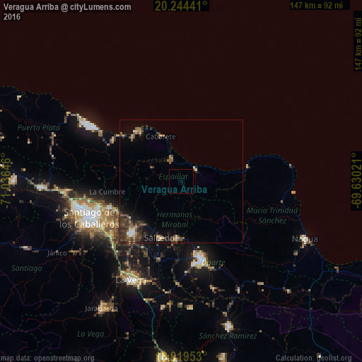
Analysis of Veragua Arriba night lights 2016
Square area 10x10 km:
 0%
0%90-99
0%80-89
0%70-79
0%60-69
0%50-59
0%40-49
0%30-39
0%20-29
0%10-19
0%0-9
100%Square area 50x50 km:
0.21%90-99
0.27%80-89
0.32%70-79
0.45%60-69
0.82%50-59
0.67%40-49
1.03%30-39
1.64%20-29
1.1%10-19
1.91%0-9
91.58%Clear (daylight) street map image can be seen on geolist.org.
Map coordinates:
20° 14' 39.9" North, 71° 2' 11.3" West
19° 34' 60" North, 70° 19' 60" West
18° 55' 10.3" North, 69° 37' 48.8" West
Some cities around Veragua Arriba sort by population:
• Moca
29.2 km =18.1 mi,  223°
223°
• Salcedo
24.5 km =15.2 mi,  201°
201°
• Salsipuedes
20.4 km =12.7 mi,  193°
193°
• Río San Juan
27.7 km =17.2 mi,  75°
75°
• Sosúa
27.1 km =16.8 mi,  313°
313°
• Tenares
23.3 km =14.5 mi,  184°
184°
• Gaspar Hernández
7.6 km =4.7 mi,  49°
49°
• San Víctor Arriba
24.3 km =15.1 mi,  240°
240°
3492073 (p: 5,858)
Sources (retrieved 2019-11-25):
» Earth at Night: Flat Maps 2012, 2016