Nizao night lights from space
Night Light of Nizao (Peravia) from space (Dominican Republic) Src. Average luminocity for 10x10km area is 23.0065% and for 50x50km: 10.1681%.
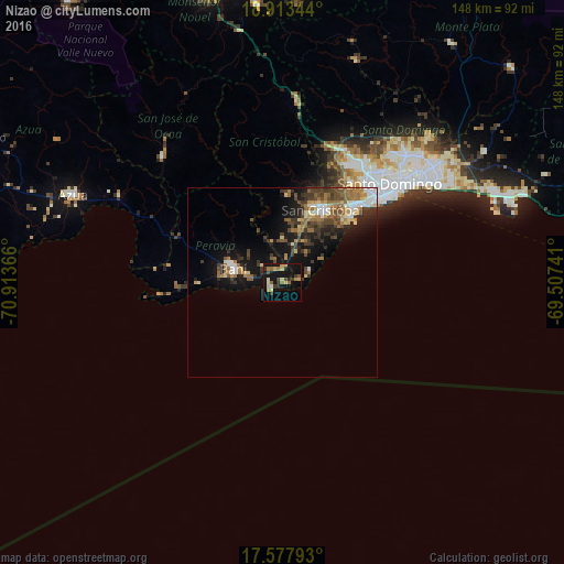
Analysis of Nizao night lights 2016
Square area 10x10 km:
 0.65%
0.65%90-99
1.95%80-89
5.41%70-79
3.68%60-69
3.46%50-59
3.03%40-49
2.6%30-39
5.84%20-29
1.73%10-19
30.52%0-9
41.13%Square area 50x50 km:
1.03%90-99
1.28%80-89
1.06%70-79
1.07%60-69
2.49%50-59
1.21%40-49
2.13%30-39
2.66%20-29
1.94%10-19
7.52%0-9
77.6%Clear (daylight) street map image can be seen on geolist.org.
Map coordinates:
18° 54' 48.4" North, 70° 54' 49.2" West
18° 14' 49.1" North, 70° 12' 37.9" West
17° 34' 40.5" North, 69° 30' 26.7" West
Some cities around Nizao sort by population:
• Santo Domingo Oeste
35.8 km =22.2 mi,  38°
38°
• San Cristóbal
22.2 km =13.8 mi,  31°
31°
• Bajos de Haina
26.5 km =16.5 mi, 44°
• Baní
13.3 km =8.3 mi,  285°
285°
• Cambita Garabitos
23.1 km =14.4 mi,  2°
2°
• San Gregorio de Nigua
20.3 km =12.6 mi, 41°
• Paya
9.1 km =5.7 mi,  280°
280°
• Yaguate
10.3 km =6.4 mi,  17°
17°
3495811 (p: 6,530)
Sources (retrieved 2019-11-25):
» Earth at Night: Flat Maps 2012, 2016