Paya night lights from space
Night Light of Paya (Peravia) from space (Dominican Republic) Src. Average luminocity for 10x10km area is 26.7087% and for 50x50km: 8.1151%.
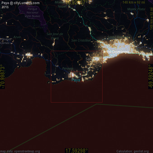
Analysis of Paya night lights 2016
Square area 10x10 km:
 2.69%
2.69%90-99
4.13%80-89
1.45%70-79
2.48%60-69
6.2%50-59
4.13%40-49
0.83%30-39
6.61%20-29
4.34%10-19
39.88%0-9
27.27%Square area 50x50 km:
0.41%90-99
0.71%80-89
0.75%70-79
0.84%60-69
1.89%50-59
1.15%40-49
2.27%30-39
2.63%20-29
1.79%10-19
7.1%0-9
80.47%Clear (daylight) street map image can be seen on geolist.org.
Map coordinates:
18° 55' 42.1" North, 70° 59' 55.4" West
18° 15' 43.1" North, 70° 17' 44.2" West
17° 35' 34.7" North, 69° 35' 32.9" West
Some cities around Paya sort by population:
• San Cristóbal
26.9 km =16.7 mi,  50°
50°
• Bajos de Haina
32.5 km =20.2 mi,  58°
58°
• Baní
4.3 km =2.7 mi,  297°
297°
• San José de Ocoa
38.7 km =24 mi,  324°
324°
• Cambita Garabitos
23.7 km =14.7 mi,  25°
25°
• San Gregorio de Nigua
26.2 km =16.3 mi, 58°
• Nizao
9.1 km =5.7 mi,  100°
100°
• Yaguate
14.6 km =9.1 mi, 55°
3495159 (p: 6,916)
Sources (retrieved 2019-11-25):
» Earth at Night: Flat Maps 2012, 2016