Santo Domingo Oeste night lights from space
Night Light of Santo Domingo Oeste (Santo Domingo) from space (Dominican Republic) Src. Average luminocity for 10x10km area is 88.7293% and for 50x50km: 25.6607%.
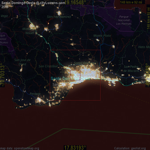
Analysis of Santo Domingo Oeste night lights 2016
Square area 10x10 km:
 37.4%
37.4%90-99
25.21%80-89
8.06%70-79
14.67%60-69
11.57%50-59
2.27%40-49
0.83%30-39
0%20-29
0%10-19
0%0-9
0%Square area 50x50 km:
5.96%90-99
5.55%80-89
2.74%70-79
2.63%60-69
3.92%50-59
1.96%40-49
3.37%30-39
4.63%20-29
5.4%10-19
10.07%0-9
53.77%Clear (daylight) street map image can be seen on geolist.org.
Map coordinates:
19° 9' 55.7" North, 70° 42' 11.3" West
18° 30' 0" North, 70° 0' 0" West
17° 49' 54.9" North, 69° 17' 48.8" West
Some cities around Santo Domingo Oeste sort by population:
• Bella Vista
7.6 km =4.7 mi,  130°
130°
• Bajos de Haina
10 km =6.2 mi,  200°
200°
• Villa Consuelo
10.7 km =6.6 mi,  99°
99°
• Cristo Rey
7 km =4.3 mi,  90°
90°
• San Carlos
10.7 km =6.6 mi, 99°
• La Julia
7.9 km =4.9 mi,  117°
117°
• La Agustina
7 km =4.3 mi, 90°
• Ensanche Luperón
10.5 km =6.5 mi, 90°
7874116 (p: 701,269)
Sources (retrieved 2019-11-25):
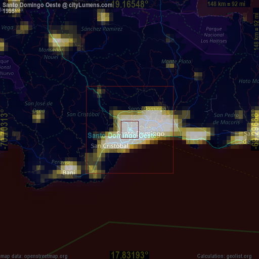
» NASA, Earths city lights 1995
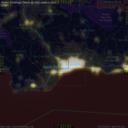
» NASA city lights 2003
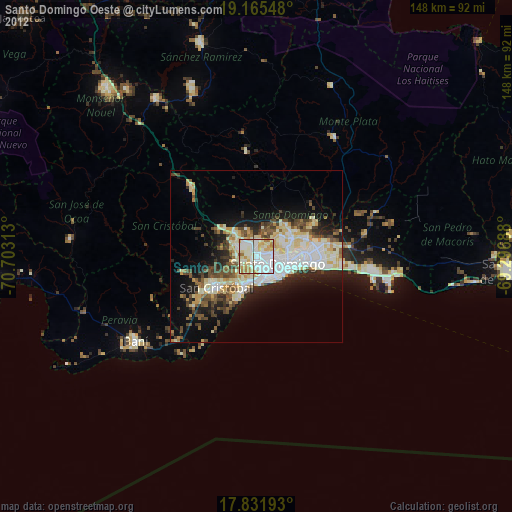
» Earth at Night: Flat Maps 2012, 2016