San Cristóbal night lights from space
Night Light of San Cristóbal from space (Dominican Republic) Src. Average luminocity for 10x10km area is 59.9112% and for 50x50km: 22.0763%.
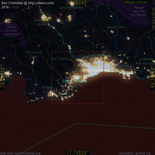
Analysis of San Cristóbal night lights 2016
Square area 10x10 km:
 6.82%
6.82%90-99
7.85%80-89
6.61%70-79
7.23%60-69
18.8%50-59
11.16%40-49
26.65%30-39
12.19%20-29
2.69%10-19
0%0-9
0%Square area 50x50 km:
4.77%90-99
4.42%80-89
2.01%70-79
2.33%60-69
3.61%50-59
1.96%40-49
3.18%30-39
4.3%20-29
4.29%10-19
10.95%0-9
58.18%Clear (daylight) street map image can be seen on geolist.org.
Map coordinates:
19° 4' 56.9" North, 70° 48' 11.3" West
18° 25' 0" North, 70° 6' 0" West
17° 44' 53.8" North, 69° 23' 48.8" West
Some cities around San Cristóbal sort by population:
• Santo Domingo Oeste
14 km =8.7 mi,  48°
48°
• Bella Vista
16.9 km =10.5 mi,  75°
75°
• Bajos de Haina
7.1 km =4.4 mi,  91°
91°
• Cristo Rey
19.9 km =12.4 mi,  62°
62°
• Cambita Garabitos
11.3 km =7 mi,  291°
291°
• La Julia
18.4 km =11.4 mi,  72°
72°
• San Gregorio de Nigua
4.1 km =2.5 mi,  154°
154°
• Yaguate
12.5 km =7.8 mi,  223°
223°
3511540 (p: 154,040)
Sources (retrieved 2019-11-25):
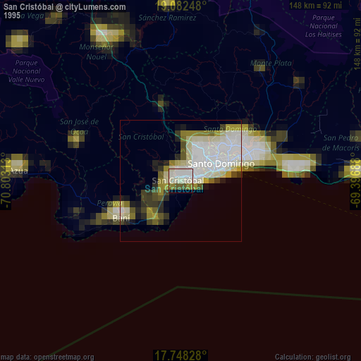
» NASA, Earths city lights 1995
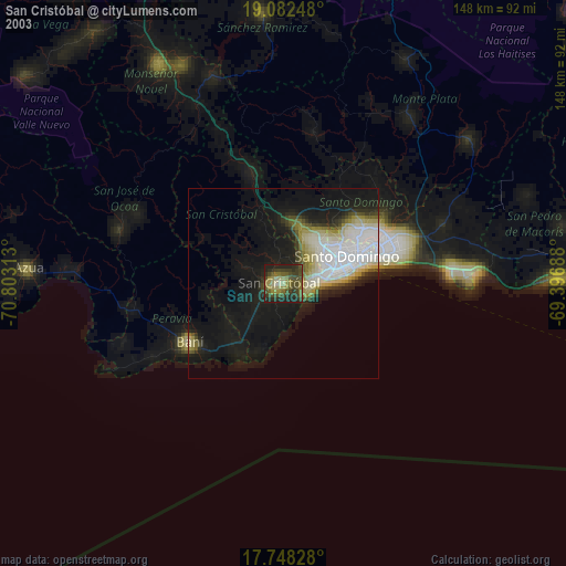
» NASA city lights 2003
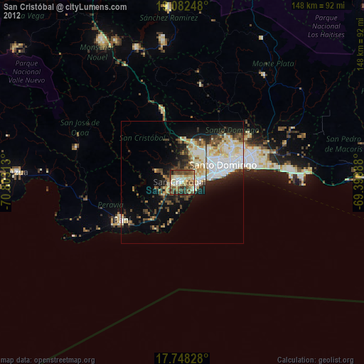
» Earth at Night: Flat Maps 2012, 2016