Jarabacoa night lights from space
Night Light of Jarabacoa (La Vega) from space (Dominican Republic) Src. Average luminocity for 10x10km area is 23.3485% and for 50x50km: 7.0282%.
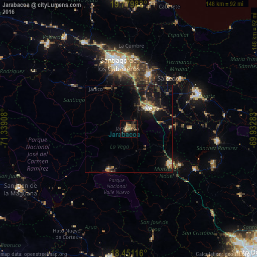
Analysis of Jarabacoa night lights 2016
Square area 10x10 km:
 0%
0%90-99
1.3%80-89
2.16%70-79
6.49%60-69
5.19%50-59
2.81%40-49
7.79%30-39
4.98%20-29
5.41%10-19
10.39%0-9
53.46%Square area 50x50 km:
0.3%90-99
0.66%80-89
0.76%70-79
0.87%60-69
1.22%50-59
0.89%40-49
1.18%30-39
1.98%20-29
2.09%10-19
6.67%0-9
83.37%Clear (daylight) street map image can be seen on geolist.org.
Map coordinates:
19° 46' 47.4" North, 71° 20' 20.7" West
19° 7' 0.6" North, 70° 38' 9.4" West
18° 27' 4.2" North, 69° 55' 58.2" West
Some cities around Jarabacoa sort by population:
• Concepción de La Vega
16.2 km =10.1 mi,  43°
43°
• Bonao
31.1 km =19.3 mi,  130°
130°
• Moca
32.9 km =20.4 mi,  20°
20°
• Constanza
25.8 km =16 mi,  206°
206°
• Fantino
35.3 km =21.9 mi,  89°
89°
• Jima Abajo
27.4 km =17 mi, 86°
• Rincón
24.1 km =15 mi, 89°
• Sabana Iglesia
26.2 km =16.3 mi,  330°
330°
3504158 (p: 29,983)
Sources (retrieved 2019-11-25):
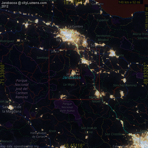
» Earth at Night: Flat Maps 2012, 2016