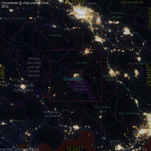
Constanza night lights from space
Night Light of Constanza (La Vega) from space (Dominican Republic) Src. Average luminocity for 10x10km area is 14.0433% and for 50x50km: 1.4986%.
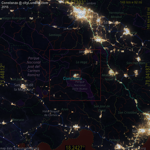
Analysis of Constanza night lights 2016
Square area 10x10 km:
 1.08%
1.08%90-99
0.87%80-89
1.08%70-79
2.81%60-69
4.76%50-59
1.52%40-49
1.3%30-39
4.33%20-29
1.73%10-19
2.16%0-9
78.35%Square area 50x50 km:
0.04%90-99
0.09%80-89
0.11%70-79
0.39%60-69
0.34%50-59
0.16%40-49
0.35%30-39
0.34%20-29
0.36%10-19
0.39%0-9
97.42%Clear (daylight) street map image can be seen on geolist.org.
Map coordinates:
19° 34' 22.9" North, 71° 26' 53.2" West
18° 54' 33.1" North, 70° 44' 42" West
18° 14' 33.7" North, 70° 2' 30.7" West
Some cities around Constanza sort by population:
• Concepción de La Vega
41.5 km =25.8 mi,  33°
33°
• Bonao
35.4 km =22 mi,  85°
85°
• Jarabacoa
25.8 km =16 mi, 26°
• Sabana Yegua
35.7 km =22.2 mi,  233°
233°
• Padre Las Casas
28.4 km =17.6 mi, 226°
• Peralta
36.5 km =22.7 mi,  184°
184°
• Rincón
42.6 km =26.5 mi,  56°
56°
• Yayas de Viajama
38.7 km =24 mi,  209°
209°
3509363 (p: 29,481)
Sources (retrieved 2019-11-25):
» Earth at Night: Flat Maps 2012, 2016