Lemvig night lights from space
Night Light of Lemvig (Central Jutland) from space (Denmark) Src. Average luminocity for 10x10km area is 3.1659% and for 50x50km: 1.5534%.
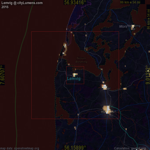
Analysis of Lemvig night lights 2016
Square area 10x10 km:
 0.23%
0.23%90-99
0.23%80-89
0.68%70-79
1.14%60-69
0%50-59
0.91%40-49
0%30-39
0.91%20-29
0%10-19
0%0-9
95.91%Square area 50x50 km:
0.19%90-99
0.17%80-89
0.22%70-79
0.23%60-69
0.19%50-59
0.2%40-49
0.08%30-39
0.44%20-29
0.16%10-19
0.79%0-9
97.34%Clear (daylight) street map image can be seen on geolist.org.
Map coordinates:
56° 56' 3" North, 7° 36' 25.5" East
56° 32' 54.8" North, 8° 18' 36.7" East
56° 9' 32.4" North, 9° 0' 48" East
Some cities around Lemvig sort by population:
• Herning
61.6 km =38.3 mi,  138°
138°
• Holstebro
28.1 km =17.5 mi, 138°
• Skive
44 km =27.3 mi,  87°
87°
• Thisted
50.9 km =31.6 mi,  27°
27°
• Struer
18.5 km =11.5 mi,  109°
109°
• Nykøbing Mors
42.9 km =26.7 mi,  50°
50°
• Ringkøbing
51.1 km =31.8 mi,  184°
184°
• Skjern
67.6 km =42 mi,  170°
170°
2617812 (p: 7,330)
Sources (retrieved 2019-11-25):
» Earth at Night: Flat Maps 2012, 2016