Hedensted night lights from space
Night Light of Hedensted (Central Jutland) from space (Denmark) Src. Average luminocity for 10x10km area is 5.0431% and for 50x50km: 4.0302%.
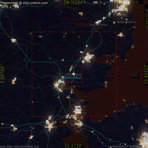
Analysis of Hedensted night lights 2016
Square area 10x10 km:
 0.12%
0.12%90-99
1.32%80-89
0%70-79
1.44%60-69
0.48%50-59
0.96%40-49
0.96%30-39
0%20-29
0%10-19
0%0-9
94.74%Square area 50x50 km:
0.6%90-99
0.72%80-89
0.3%70-79
0.41%60-69
0.37%50-59
0.35%40-49
0.57%30-39
0.61%20-29
0.67%10-19
3.78%0-9
91.61%Clear (daylight) street map image can be seen on geolist.org.
Map coordinates:
56° 9' 50.2" North, 8° 59' 52.7" East
55° 46' 13.5" North, 9° 42' 4" East
55° 22' 22.4" North, 10° 24' 15.2" East
Some cities around Hedensted sort by population:
• Horsens
13.7 km =8.5 mi,  42°
42°
• Kolding
34.3 km =21.3 mi,  204°
204°
• Vejle
12.4 km =7.7 mi,  236°
236°
• Fredericia
23 km =14.3 mi,  171°
171°
• Middelfart
29.5 km =18.3 mi,  176°
176°
• Skanderborg
32.7 km =20.3 mi,  26°
26°
• Odder
36.1 km =22.4 mi,  51°
51°
• Billund
37.3 km =23.2 mi,  263°
263°
2620583 (p: 10,048)
Sources (retrieved 2019-11-25):
» Earth at Night: Flat Maps 2012, 2016