Horsens night lights from space
Night Light of Horsens (Central Jutland) from space (Denmark) Src. Average luminocity for 10x10km area is 25.8158% and for 50x50km: 3.5702%.
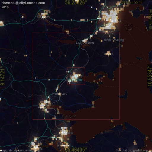
Analysis of Horsens night lights 2016
Square area 10x10 km:
 5.01%
5.01%90-99
5.64%80-89
3.01%70-79
1.88%60-69
3.88%50-59
2.26%40-49
1.38%30-39
0.63%20-29
1.88%10-19
33.58%0-9
40.85%Square area 50x50 km:
0.45%90-99
0.55%80-89
0.33%70-79
0.33%60-69
0.38%50-59
0.4%40-49
0.52%30-39
0.69%20-29
0.34%10-19
3%0-9
93%Clear (daylight) street map image can be seen on geolist.org.
Map coordinates:
56° 15' 11.7" North, 9° 8' 50" East
55° 51' 38.4" North, 9° 51' 1.2" East
55° 27' 50.6" North, 10° 33' 12.5" East
Some cities around Horsens sort by population:
• Vejle
25.9 km =16.1 mi,  229°
229°
• Fredericia
33.4 km =20.8 mi,  190°
190°
• Skanderborg
20 km =12.4 mi,  14°
14°
• Odder
22.6 km =14 mi,  56°
56°
• Hedensted
13.7 km =8.5 mi,  222°
222°
• Tranbjerg
31.6 km =19.6 mi,  34°
34°
• Hørning
27.7 km =17.2 mi,  24°
24°
• Kolt
30.7 km =19.1 mi, 26°
2619771 (p: 58,646)
Sources (retrieved 2019-11-25):
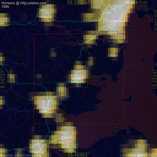
» NASA, Earths city lights 1995
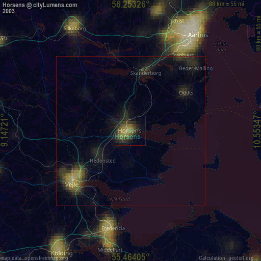
» NASA city lights 2003
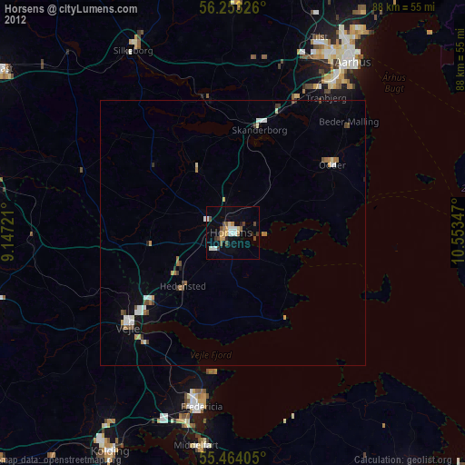
» Earth at Night: Flat Maps 2012, 2016