Birkerød night lights from space
Night Light of Birkerød (Capital Region) from space (Denmark) Src. Average luminocity for 10x10km area is 28.9624% and for 50x50km: 23.3822%.
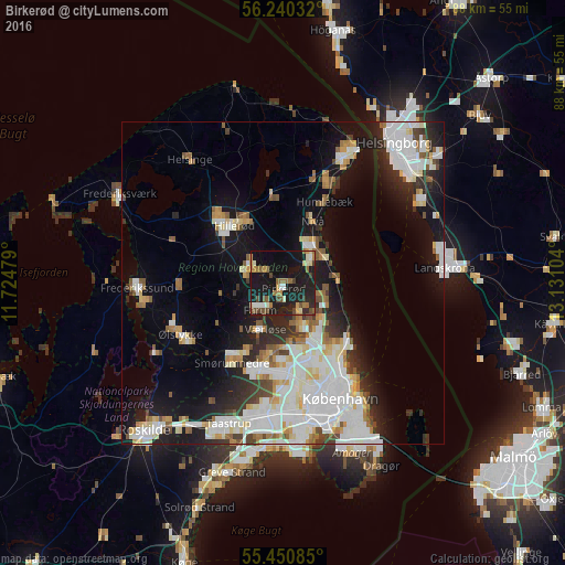
Analysis of Birkerød night lights 2016
Square area 10x10 km:
 1.25%
1.25%90-99
4.64%80-89
2.63%70-79
2.13%60-69
6.64%50-59
4.01%40-49
6.02%30-39
1.75%20-29
6.77%10-19
50%0-9
14.16%Square area 50x50 km:
6.58%90-99
5.79%80-89
2.23%70-79
1.76%60-69
2.04%50-59
2.17%40-49
1.84%30-39
1.95%20-29
4.23%10-19
13.06%0-9
58.33%Clear (daylight) street map image can be seen on geolist.org.
Map coordinates:
56° 14' 25.2" North, 11° 43' 29.2" East
55° 50' 51.3" North, 12° 25' 40.5" East
55° 27' 3.1" North, 13° 7' 51.7" East
Some cities around Birkerød sort by population:
• Hørsholm
5.9 km =3.7 mi,  50°
50°
• Farum
6 km =3.7 mi,  224°
224°
• Lillerød
6 km =3.7 mi,  300°
300°
• Værløse
8.1 km =5 mi,  207°
207°
• Kongens Lyngby
9.8 km =6.1 mi,  151°
151°
• Trørød
7.3 km =4.5 mi,  97°
97°
• Nivå
10.7 km =6.6 mi,  26°
26°
• Stavnsholt
3.9 km =2.4 mi,  201°
201°
2624112 (p: 18,901)
Sources (retrieved 2019-11-25):
» Earth at Night: Flat Maps 2012, 2016