Wunsiedel night lights from space
Night Light of Wunsiedel (Bavaria) from space (Germany) Src. Average luminocity for 10x10km area is 1.6134% and for 50x50km: 1.5865%.
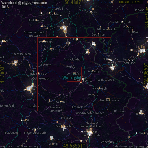
Analysis of Wunsiedel night lights 2016
Square area 10x10 km:
 0%
0%90-99
0%80-89
0%70-79
0%60-69
0.28%50-59
0%40-49
0.56%30-39
1.68%20-29
0.56%10-19
0.14%0-9
96.78%Square area 50x50 km:
0.23%90-99
0.25%80-89
0.17%70-79
0.16%60-69
0.16%50-59
0.19%40-49
0.29%30-39
0.34%20-29
0.11%10-19
0.18%0-9
97.92%Clear (daylight) street map image can be seen on geolist.org.
Map coordinates:
50° 29' 19.3" North, 11° 18' 1.1" East
50° 2' 21.2" North, 12° 0' 12.3" East
49° 35' 7.8" North, 12° 42' 23.6" East
Some cities around Wunsiedel sort by population:
• Marktredwitz
7.1 km =4.4 mi,  123°
123°
• Selb
17.2 km =10.7 mi,  31°
31°
• Schwarzenbach an der Saale
21 km =13 mi,  346°
346°
• Waldsassen
21.9 km =13.6 mi,  100°
100°
• Mitterteich
19.7 km =12.2 mi, 119°
• Arzberg
13.3 km =8.3 mi,  81°
81°
• Erbendorf
22.4 km =13.9 mi,  172°
172°
• Kemnath
20.5 km =12.7 mi,  203°
203°
2805762 (p: 10,295)
Sources (retrieved 2019-11-25):
» Earth at Night: Flat Maps 2012, 2016