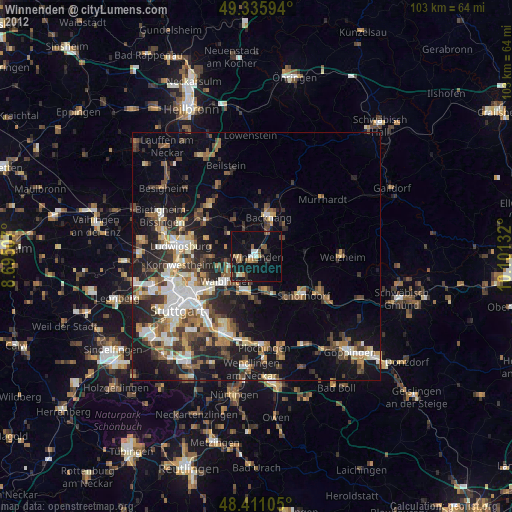
Winnenden night lights from space
Night Light of Winnenden (Baden-Württemberg) from space (Germany) Src. Average luminocity for 10x10km area is 19.4773% and for 50x50km: 24.1145%.
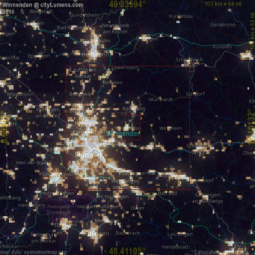
Analysis of Winnenden night lights 2016
Square area 10x10 km:
 1.14%
1.14%90-99
1.56%80-89
2.56%70-79
1.14%60-69
2.7%50-59
1.42%40-49
4.12%30-39
1.99%20-29
5.26%10-19
39.91%0-9
38.21%Square area 50x50 km:
4.07%90-99
4.47%80-89
2.02%70-79
2.76%60-69
3.31%50-59
3.27%40-49
3.74%30-39
3.98%20-29
7.18%10-19
13.8%0-9
51.42%Clear (daylight) street map image can be seen on geolist.org.
Map coordinates:
49° 20' 9.4" North, 8° 41' 42.3" East
48° 52' 32.3" North, 9° 23' 53.5" East
48° 24' 39.8" North, 10° 6' 4.8" East
Some cities around Winnenden sort by population:
• Waiblingen
7.7 km =4.8 mi,  231°
231°
• Backnang
8.5 km =5.3 mi,  19°
19°
• Weinstadt-Endersbach
7.4 km =4.6 mi,  199°
199°
• Rudersberg
9.6 km =6 mi,  83°
83°
• Leutenbach
1.4 km =0.9 mi,  343°
343°
• Korb
4.5 km =2.8 mi,  215°
215°
• Schwaikheim
3.6 km =2.2 mi,  273°
273°
• Mittelschöntal
7.8 km =4.8 mi,  358°
358°
2807872 (p: 27,783)
Sources (retrieved 2019-11-25):
» Earth at Night: Flat Maps 2012, 2016