Wiehl night lights from space
Night Light of Wiehl (North Rhine-Westphalia) from space (Germany) Src. Average luminocity for 10x10km area is 2.7283% and for 50x50km: 3.4183%.
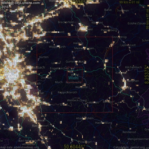
Analysis of Wiehl night lights 2016
Square area 10x10 km:
 0%
0%90-99
0%80-89
0%70-79
0.14%60-69
0.42%50-59
0.84%40-49
1.4%30-39
1.12%20-29
0.56%10-19
1.82%0-9
93.7%Square area 50x50 km:
0.19%90-99
0.36%80-89
0.28%70-79
0.39%60-69
0.58%50-59
0.61%40-49
0.59%30-39
0.67%20-29
1.19%10-19
2.14%0-9
92.99%Clear (daylight) street map image can be seen on geolist.org.
Map coordinates:
51° 23' 25.3" North, 6° 50' 51" East
50° 56' 58.2" North, 7° 33' 2.2" East
50° 30' 15.9" North, 8° 15' 13.5" East
Some cities around Wiehl sort by population:
• Gummersbach
8.6 km =5.3 mi,  6°
6°
• Lindlar
14.4 km =8.9 mi,  302°
302°
• Engelskirchen
10.5 km =6.5 mi,  294°
294°
• Bergneustadt
11.2 km =7 mi,  41°
41°
• Waldbröl
9.4 km =5.8 mi,  150°
150°
• Nümbrecht
5.1 km =3.2 mi,  187°
187°
• Much
11.5 km =7.1 mi,  243°
243°
• Ruppichteroth
12.7 km =7.9 mi,  201°
201°
2809517 (p: 26,291)
Sources (retrieved 2019-11-25):
» Earth at Night: Flat Maps 2012, 2016