Weil der Stadt night lights from space
Night Light of Weil der Stadt (Baden-Württemberg) from space (Germany) Src. Average luminocity for 10x10km area is 8.7158% and for 50x50km: 21.2324%.
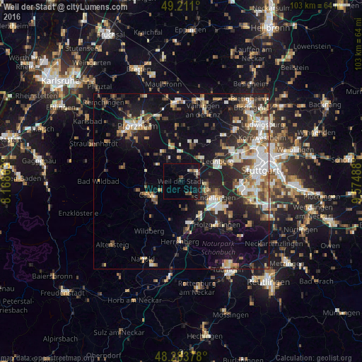
Analysis of Weil der Stadt night lights 2016
Square area 10x10 km:
 0.74%
0.74%90-99
1.04%80-89
0.6%70-79
0.6%60-69
0.45%50-59
0.6%40-49
1.93%30-39
2.23%20-29
1.19%10-19
7.89%0-9
82.74%Square area 50x50 km:
3.41%90-99
4.07%80-89
1.87%70-79
2.48%60-69
2.74%50-59
2.37%40-49
2.93%30-39
2.98%20-29
6.27%10-19
13.85%0-9
57.04%Clear (daylight) street map image can be seen on geolist.org.
Map coordinates:
49° 12' 39.6" North, 8° 10' 7.1" East
48° 44' 58.3" North, 8° 52' 18.3" East
48° 17' 1.6" North, 9° 34' 29.6" East
Some cities around Weil der Stadt sort by population:
• Renningen
5.4 km =3.4 mi,  65°
65°
• Rutesheim
8.5 km =5.3 mi,  39°
39°
• Aidlingen
8.1 km =5 mi,  167°
167°
• Magstadt
7 km =4.3 mi,  94°
94°
• Althengstett
6.4 km =4 mi,  242°
242°
• Grafenau
4.9 km =3 mi,  142°
142°
• Neuhausen
8.5 km =5.3 mi,  304°
304°
• Heimsheim
6.3 km =3.9 mi,  357°
357°
2812625 (p: 19,338)
Sources (retrieved 2019-11-25):
» Earth at Night: Flat Maps 2012, 2016