Grafenau night lights from space
Night Light of Grafenau (Baden-Württemberg) from space (Germany) Src. Average luminocity for 10x10km area is 17.9673% and for 50x50km: 23.3281%.
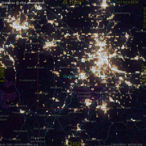
Analysis of Grafenau night lights 2016
Square area 10x10 km:
 0.89%
0.89%90-99
0.6%80-89
2.38%70-79
2.68%60-69
2.08%50-59
3.87%40-49
1.19%30-39
5.36%20-29
7.29%10-19
23.07%0-9
50.6%Square area 50x50 km:
3.93%90-99
4.83%80-89
2.14%70-79
2.44%60-69
3.24%50-59
2.69%40-49
2.96%30-39
3.4%20-29
6.5%10-19
13.96%0-9
53.92%Clear (daylight) street map image can be seen on geolist.org.
Map coordinates:
49° 10' 33.8" North, 8° 12' 32.7" East
48° 42' 51.4" North, 8° 54' 43.9" East
48° 14' 53.5" North, 9° 36' 55.2" East
Some cities around Grafenau sort by population:
• Sindelfingen
7.8 km =4.8 mi,  101°
101°
• Böblingen
8.1 km =5 mi,  116°
116°
• Weil der Stadt
4.9 km =3 mi,  322°
322°
• Renningen
6.5 km =4 mi,  17°
17°
• Gärtringen
8.1 km =5 mi,  185°
185°
• Aidlingen
4.2 km =2.6 mi,  197°
197°
• Magstadt
5.2 km =3.2 mi,  49°
49°
• Ehningen
6.5 km =4 mi,  160°
160°
11670103 (p: 6,425)
Sources (retrieved 2019-11-25):
» Earth at Night: Flat Maps 2012, 2016