Velbert night lights from space
Night Light of Velbert (North Rhine-Westphalia) from space (Germany) Src. Average luminocity for 10x10km area is 31.4664% and for 50x50km: 51.4698%.
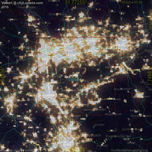
Analysis of Velbert night lights 2016
Square area 10x10 km:
 3.36%
3.36%90-99
3.78%80-89
2.1%70-79
1.96%60-69
3.5%50-59
7.14%40-49
3.78%30-39
2.8%20-29
20.17%10-19
50.7%0-9
0.7%Square area 50x50 km:
11.64%90-99
12.45%80-89
5.55%70-79
6.33%60-69
6.53%50-59
5.9%40-49
5.67%30-39
8.6%20-29
11.48%10-19
15.19%0-9
10.66%Clear (daylight) street map image can be seen on geolist.org.
Map coordinates:
51° 46' 21.2" North, 6° 20' 25.3" East
51° 20' 7.3" North, 7° 2' 36.5" East
50° 53' 38.3" North, 7° 44' 47.8" East
Some cities around Velbert sort by population:
• Essen
13.6 km =8.5 mi,  350°
350°
• Wuppertal
11.4 km =7.1 mi,  140°
140°
• Ratingen
14.1 km =8.8 mi,  252°
252°
• Hattingen
12.1 km =7.5 mi,  54°
54°
• Mettmann
10.6 km =6.6 mi,  206°
206°
• Heiligenhaus
5.1 km =3.2 mi,  259°
259°
• Sprockhövel
13.9 km =8.6 mi,  84°
84°
• Wülfrath
6 km =3.7 mi,  183°
183°
2817724 (p: 87,669)
Sources (retrieved 2019-11-25):
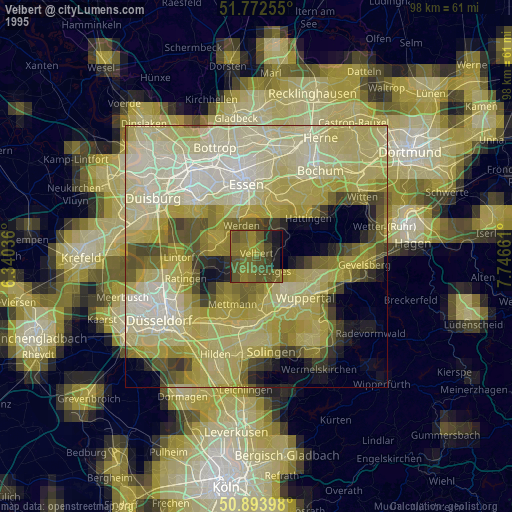
» NASA, Earths city lights 1995
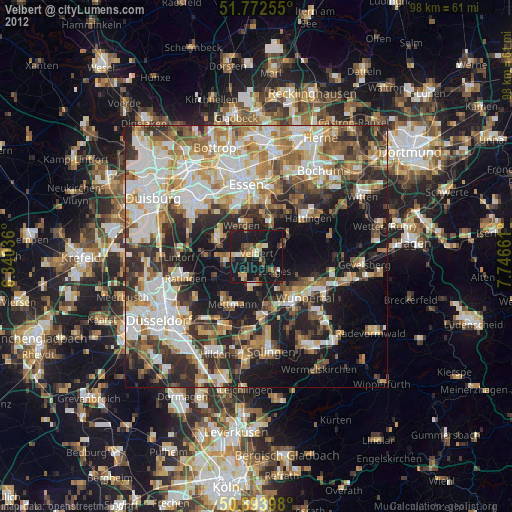
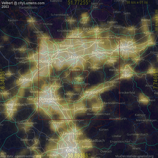
» NASA city lights 2003
» Earth at Night: Flat Maps 2012, 2016