Sprockhövel night lights from space
Night Light of Sprockhövel (North Rhine-Westphalia) from space (Germany) Src. Average luminocity for 10x10km area is 14.7031% and for 50x50km: 41.4257%.
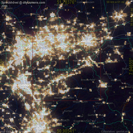
Analysis of Sprockhövel night lights 2016
Square area 10x10 km:
 0%
0%90-99
0.28%80-89
0.84%70-79
0%60-69
2.24%50-59
1.96%40-49
1.82%30-39
1.12%20-29
4.76%10-19
43.84%0-9
43.14%Square area 50x50 km:
7.3%90-99
8.3%80-89
4.95%70-79
5.75%60-69
6.24%50-59
5.87%40-49
5.39%30-39
6.23%20-29
11.74%10-19
16.53%0-9
21.69%Clear (daylight) street map image can be seen on geolist.org.
Map coordinates:
51° 47' 1.5" North, 6° 32' 25.1" East
51° 20' 48.1" North, 7° 14' 36.3" East
50° 54' 19.5" North, 7° 56' 47.6" East
Some cities around Sprockhövel sort by population:
• Wuppertal
12 km =7.5 mi,  213°
213°
• Witten
13.2 km =8.2 mi,  35°
35°
• Velbert
13.9 km =8.6 mi,  264°
264°
• Hattingen
7.1 km =4.4 mi,  325°
325°
• Gevelsberg
7.3 km =4.5 mi,  114°
114°
• Ennepetal
9.9 km =6.2 mi,  122°
122°
• Schwelm
7.6 km =4.7 mi,  152°
152°
• Wetter (Ruhr)
11.3 km =7 mi,  66°
66°
2829998 (p: 26,400)
Sources (retrieved 2019-11-25):
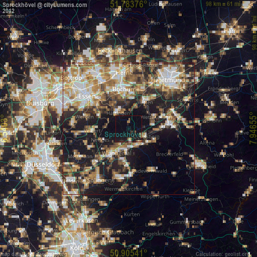
» Earth at Night: Flat Maps 2012, 2016