Straubing night lights from space
Night Light of Straubing (Bavaria) from space (Germany) Src. Average luminocity for 10x10km area is 21.223% and for 50x50km: 2.2811%.
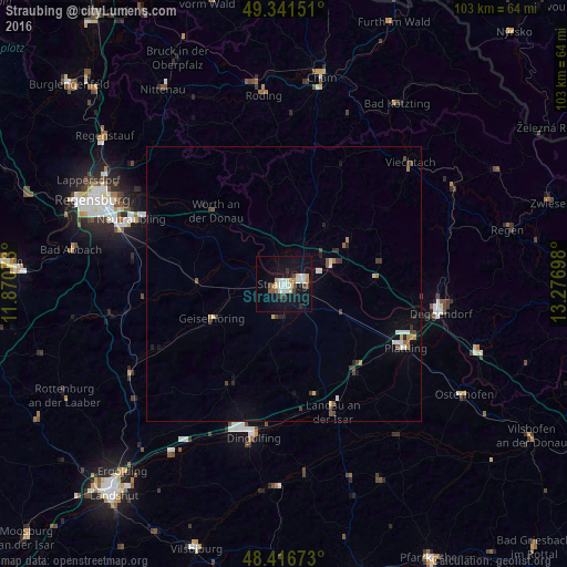
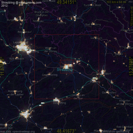
Analysis of Straubing night lights 2016
Square area 10x10 km:
 2.56%
2.56%90-99
5.82%80-89
2.98%70-79
1.7%60-69
0.99%50-59
1.14%40-49
3.27%30-39
1.99%20-29
0.71%10-19
24.43%0-9
54.4%Square area 50x50 km:
0.23%90-99
0.39%80-89
0.27%70-79
0.13%60-69
0.24%50-59
0.2%40-49
0.49%30-39
0.36%20-29
0.25%10-19
1.32%0-9
96.13%Clear (daylight) street map image can be seen on geolist.org.
Map coordinates:
49° 20' 29.4" North, 11° 52' 14.6" East
48° 52' 52.5" North, 12° 34' 25.9" East
48° 25' 0.2" North, 13° 16' 37.1" East
Some cities around Straubing sort by population:
• Dingolfing
27.2 km =16.9 mi,  192°
192°
• Landau an der Isar
24.8 km =15.4 mi,  159°
159°
• Plattling
24.8 km =15.4 mi,  117°
117°
• Bogen
9.1 km =5.7 mi,  68°
68°
• Geiselhöring
14.4 km =8.9 mi,  244°
244°
• Wallersdorf
20.4 km =12.7 mi,  141°
141°
• Pilsting
20.8 km =12.9 mi, 164°
• Mengkofen
20.5 km =12.7 mi,  208°
208°
2826099 (p: 44,580)
Sources (retrieved 2019-11-25):
» Earth at Night: Flat Maps 2012, 2016