Wallersdorf night lights from space
Night Light of Wallersdorf (Bavaria) from space (Germany) Src. Average luminocity for 10x10km area is 2.1473% and for 50x50km: 3.4517%.
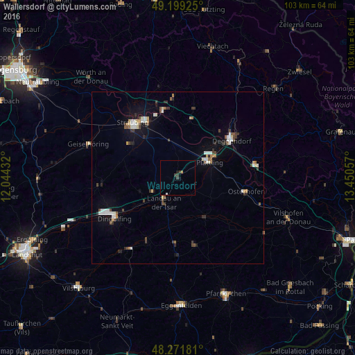
Analysis of Wallersdorf night lights 2016
Square area 10x10 km:
 0.15%
0.15%90-99
0.15%80-89
0%70-79
0%60-69
0.6%50-59
0%40-49
0.45%30-39
1.93%20-29
0.45%10-19
0.74%0-9
95.54%Square area 50x50 km:
0.47%90-99
0.69%80-89
0.32%70-79
0.2%60-69
0.27%50-59
0.29%40-49
0.69%30-39
0.54%20-29
0.5%10-19
1.54%0-9
94.48%Clear (daylight) street map image can be seen on geolist.org.
Map coordinates:
49° 11' 57.3" North, 12° 2' 39.6" East
48° 44' 15.6" North, 12° 44' 50.8" East
48° 16' 18.5" North, 13° 27' 2.1" East
Some cities around Wallersdorf sort by population:
• Straubing
20.4 km =12.7 mi,  321°
321°
• Deggendorf
19.4 km =12.1 mi,  53°
53°
• Landau an der Isar
8.3 km =5.2 mi,  208°
208°
• Plattling
10.4 km =6.5 mi,  64°
64°
• Osterhofen
20.6 km =12.8 mi,  101°
101°
• Bogen
19.8 km =12.3 mi,  347°
347°
• Eichendorf
14.1 km =8.8 mi,  145°
145°
• Pilsting
8.2 km =5.1 mi,  240°
240°
2814599 (p: 6,702)
Sources (retrieved 2019-11-25):
» Earth at Night: Flat Maps 2012, 2016