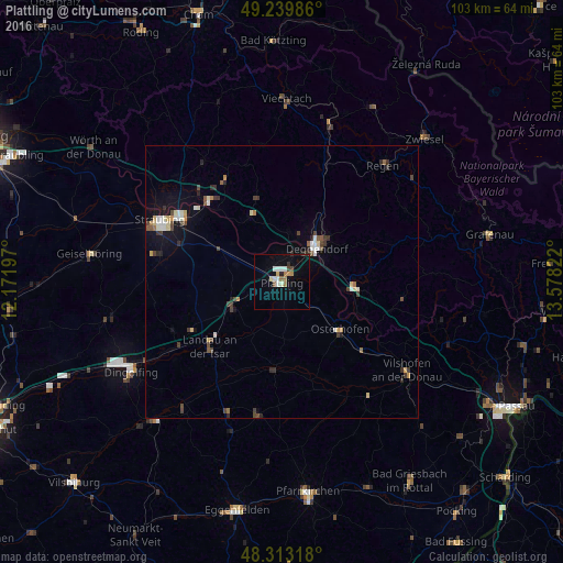
Plattling night lights from space
Night Light of Plattling (Bavaria) from space (Germany) Src. Average luminocity for 10x10km area is 12.3608% and for 50x50km: 2.9081%.
Analysis of Plattling night lights 2016
Square area 10x10 km:
 2.13%
2.13%90-99
2.41%80-89
0.85%70-79
0.99%60-69
1.7%50-59
1.14%40-49
1.56%30-39
0.28%20-29
1.42%10-19
1.7%0-9
85.8%Square area 50x50 km:
0.33%90-99
0.51%80-89
0.33%70-79
0.21%60-69
0.24%50-59
0.29%40-49
0.56%30-39
0.63%20-29
0.49%10-19
1.24%0-9
95.17%Clear (daylight) street map image can be seen on geolist.org.
Map coordinates:
49° 14' 23.5" North, 12° 10' 19.1" East
48° 46' 43.2" North, 12° 52' 30.3" East
48° 18' 47.4" North, 13° 34' 41.6" East
Some cities around Plattling sort by population:
• Deggendorf
9.3 km =5.8 mi,  42°
42°
• Landau an der Isar
17.8 km =11.1 mi,  228°
228°
• Osterhofen
13.9 km =8.6 mi,  129°
129°
• Bogen
20 km =12.4 mi,  317°
317°
• Hengersberg
13.2 km =8.2 mi,  92°
92°
• Wallersdorf
10.4 km =6.5 mi,  244°
244°
• Eichendorf
16.3 km =10.1 mi,  184°
184°
• Pilsting
18.6 km =11.6 mi, 242°
2853310 (p: 12,390)
Sources (retrieved 2019-11-25):
» Earth at Night: Flat Maps 2012, 2016