Bogen night lights from space
Night Light of Bogen (Bavaria) from space (Germany) Src. Average luminocity for 10x10km area is 9.2713% and for 50x50km: 2.6665%.
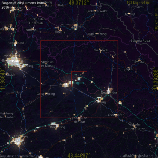
Analysis of Bogen night lights 2016
Square area 10x10 km:
 0.71%
0.71%90-99
1.7%80-89
0.71%70-79
0.99%60-69
0.99%50-59
0.99%40-49
2.13%30-39
1.42%20-29
1.56%10-19
2.41%0-9
86.36%Square area 50x50 km:
0.32%90-99
0.47%80-89
0.28%70-79
0.18%60-69
0.26%50-59
0.25%40-49
0.51%30-39
0.46%20-29
0.39%10-19
1.28%0-9
95.6%Clear (daylight) street map image can be seen on geolist.org.
Map coordinates:
49° 22' 16.3" North, 11° 59' 11.1" East
48° 54' 40.4" North, 12° 41' 22.4" East
48° 26' 49.1" North, 13° 23' 33.6" East
Some cities around Bogen sort by population:
• Straubing
9.1 km =5.7 mi,  248°
248°
• Deggendorf
21.3 km =13.2 mi,  111°
111°
• Landau an der Isar
26.5 km =16.5 mi,  179°
179°
• Plattling
20 km =12.4 mi,  137°
137°
• Viechtach
23.6 km =14.7 mi,  37°
37°
• Geiselhöring
23.5 km =14.6 mi, 245°
• Wallersdorf
19.8 km =12.3 mi,  167°
167°
• Pilsting
23.5 km =14.6 mi,  186°
186°
2947026 (p: 10,259)
Sources (retrieved 2019-11-25):
» Earth at Night: Flat Maps 2012, 2016