Dingolfing night lights from space
Night Light of Dingolfing (Bavaria) from space (Germany) Src. Average luminocity for 10x10km area is 15.064% and for 50x50km: 2.6163%.
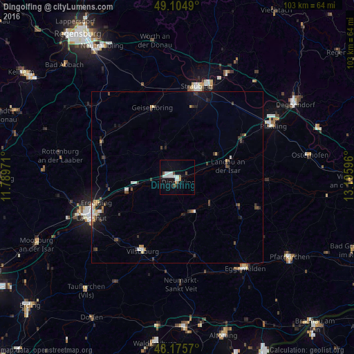
Analysis of Dingolfing night lights 2016
Square area 10x10 km:
 3.57%
3.57%90-99
4.61%80-89
0.15%70-79
0.6%60-69
0.6%50-59
0.6%40-49
2.98%30-39
0.6%20-29
0.6%10-19
7.44%0-9
78.27%Square area 50x50 km:
0.34%90-99
0.41%80-89
0.17%70-79
0.19%60-69
0.25%50-59
0.25%40-49
0.54%30-39
0.56%20-29
0.46%10-19
1.69%0-9
95.15%Clear (daylight) street map image can be seen on geolist.org.
Map coordinates:
49° 6' 17.6" North, 11° 47' 23" East
48° 38' 32.8" North, 12° 29' 34.2" East
48° 10' 32.5" North, 13° 11' 45.5" East
Some cities around Dingolfing sort by population:
• Landau an der Isar
15.1 km =9.4 mi,  77°
77°
• Essenbach
20.4 km =12.7 mi,  260°
260°
• Reisbach
12.8 km =8 mi,  128°
128°
• Ruhstorf
18.1 km =11.2 mi, 129°
• Geiselhöring
21.5 km =13.4 mi,  340°
340°
• Wallersdorf
21.5 km =13.4 mi,  60°
60°
• Pilsting
13.3 km =8.3 mi, 60°
• Mengkofen
9.3 km =5.8 mi, 335°
2936909 (p: 18,805)
Sources (retrieved 2019-11-25):
» Earth at Night: Flat Maps 2012, 2016