Schwelm night lights from space
Night Light of Schwelm (North Rhine-Westphalia) from space (Germany) Src. Average luminocity for 10x10km area is 32.437% and for 50x50km: 31.4886%.
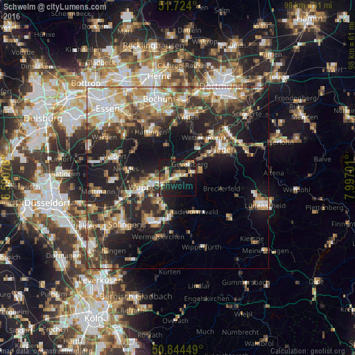
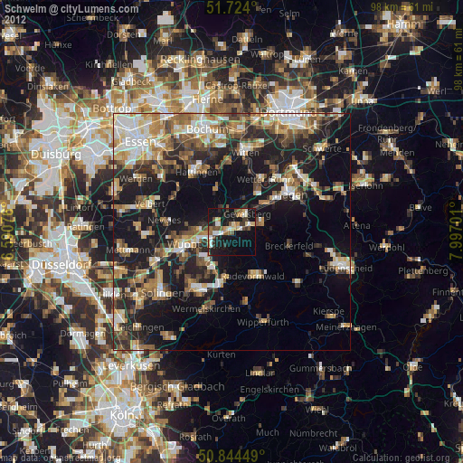
Analysis of Schwelm night lights 2016
Square area 10x10 km:
 1.96%
1.96%90-99
3.36%80-89
5.18%70-79
5.18%60-69
5.46%50-59
6.86%40-49
2.66%30-39
2.52%20-29
12.18%10-19
39.78%0-9
14.85%Square area 50x50 km:
4.82%90-99
5.37%80-89
3.62%70-79
4.17%60-69
4.56%50-59
4.63%40-49
4.62%30-39
5.17%20-29
10.85%10-19
17.32%0-9
34.87%Clear (daylight) street map image can be seen on geolist.org.
Map coordinates:
51° 43' 26.4" North, 6° 35' 26.7" East
51° 17' 10.9" North, 7° 17' 38" East
50° 50' 40.2" North, 7° 59' 49.2" East
Some cities around Schwelm sort by population:
• Wuppertal
10.7 km =6.6 mi,  251°
251°
• Remscheid
13.8 km =8.6 mi,  210°
210°
• Gevelsberg
4.9 km =3 mi,  40°
40°
• Ennepetal
5 km =3.1 mi,  74°
74°
• Wetter (Ruhr)
13.2 km =8.2 mi,  31°
31°
• Sprockhövel
7.6 km =4.7 mi,  332°
332°
• Radevormwald
10.4 km =6.5 mi,  153°
153°
• Breckerfeld
12.5 km =7.8 mi,  103°
103°
2834372 (p: 30,235)
Sources (retrieved 2019-11-25):
» Earth at Night: Flat Maps 2012, 2016