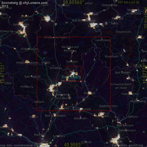
Sonneberg night lights from space
Night Light of Sonneberg (Thuringia) from space (Germany) Src. Average luminocity for 10x10km area is 8.465% and for 50x50km: 1.9948%.
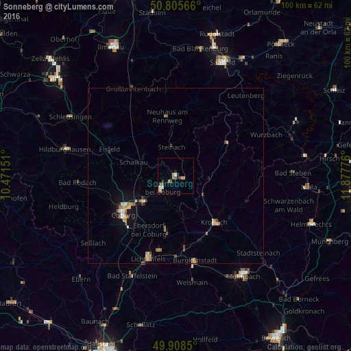
Analysis of Sonneberg night lights 2016
Square area 10x10 km:
 0.28%
0.28%90-99
1.68%80-89
1.12%70-79
1.4%60-69
2.1%50-59
1.4%40-49
1.26%30-39
0.28%20-29
1.12%10-19
1.12%0-9
88.24%Square area 50x50 km:
0.17%90-99
0.29%80-89
0.18%70-79
0.3%60-69
0.39%50-59
0.29%40-49
0.35%30-39
0.08%20-29
0.22%10-19
1.04%0-9
96.71%Clear (daylight) street map image can be seen on geolist.org.
Map coordinates:
50° 48' 20.4" North, 10° 28' 17.4" East
50° 21' 33.1" North, 11° 10' 28.7" East
49° 54' 30.6" North, 11° 52' 39.9" East
Some cities around Sonneberg sort by population:
• Coburg
18.6 km =11.6 mi,  233°
233°
• Kronach
17.4 km =10.8 mi,  139°
139°
• Neustadt bei Coburg
5 km =3.1 mi, 229°
• Rödental
11.8 km =7.3 mi, 233°
• Kueps Oberfranken
19.9 km =12.4 mi,  158°
158°
• Neuhaus am Rennweg
17 km =10.6 mi,  351°
351°
• Ebersdorf
3.7 km =2.3 mi,  204°
204°
• Stockheim
9.6 km =6 mi,  127°
127°
2831250 (p: 23,908)
Sources (retrieved 2019-11-25):
» Earth at Night: Flat Maps 2012, 2016