Neuhaus am Rennweg night lights from space
Night Light of Neuhaus am Rennweg (Thuringia) from space (Germany) Src. Average luminocity for 10x10km area is 0.8053% and for 50x50km: 2.3216%.
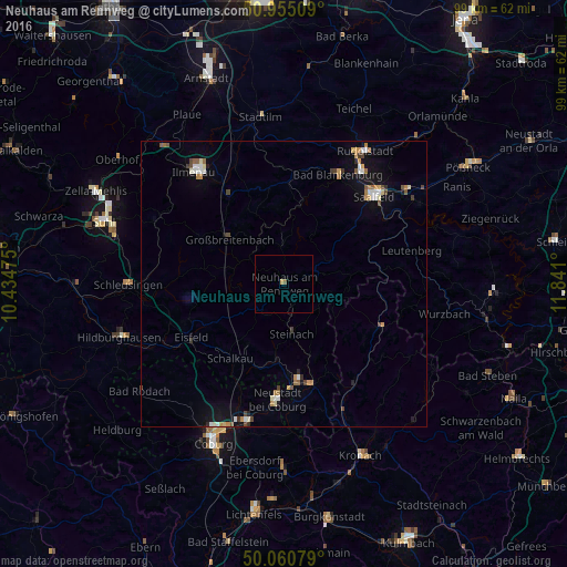
Analysis of Neuhaus am Rennweg night lights 2016
Square area 10x10 km:
 0%
0%90-99
0%80-89
0%70-79
0.56%60-69
0%50-59
0.56%40-49
0%30-39
0%20-29
0%10-19
0%0-9
98.88%Square area 50x50 km:
0.23%90-99
0.44%80-89
0.18%70-79
0.32%60-69
0.33%50-59
0.26%40-49
0.38%30-39
0.18%20-29
0.22%10-19
1.13%0-9
96.32%Clear (daylight) street map image can be seen on geolist.org.
Map coordinates:
50° 57' 18.3" North, 10° 26' 5.1" East
50° 30' 36.2" North, 11° 8' 16.3" East
50° 3' 38.8" North, 11° 50' 27.6" East
Some cities around Neuhaus am Rennweg sort by population:
• Saalfeld
22.2 km =13.8 mi,  46°
46°
• Ilmenau
24.7 km =15.3 mi,  321°
321°
• Sonneberg
17 km =10.6 mi,  171°
171°
• Neustadt bei Coburg
20.1 km =12.5 mi,  183°
183°
• Bad Blankenburg
21.4 km =13.3 mi,  26°
26°
• Ebersdorf
20.2 km =12.6 mi, 177°
• Eisfeld
18.8 km =11.7 mi,  240°
240°
• Königsee
17.1 km =10.6 mi,  350°
350°
2865133 (p: 6,485)
Sources (retrieved 2019-11-25):
» Earth at Night: Flat Maps 2012, 2016