Sinzheim night lights from space
Night Light of Sinzheim (Baden-Württemberg) from space (Germany) Src. Average luminocity for 10x10km area is 22.919% and for 50x50km: 11.8589%.
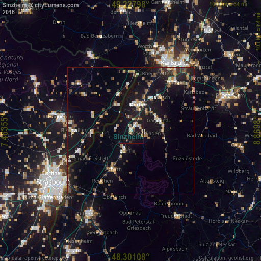
Analysis of Sinzheim night lights 2016
Square area 10x10 km:
 2.7%
2.7%90-99
2.13%80-89
2.13%70-79
3.69%60-69
3.27%50-59
1.99%40-49
2.56%30-39
1.7%20-29
3.55%10-19
39.63%0-9
36.65%Square area 50x50 km:
1.02%90-99
1.42%80-89
1.02%70-79
1.37%60-69
1.2%50-59
1.87%40-49
1.82%30-39
1.89%20-29
2.76%10-19
13.32%0-9
72.31%Clear (daylight) street map image can be seen on geolist.org.
Map coordinates:
49° 13' 40.7" North, 7° 27' 48.8" East
48° 46' 0" North, 8° 10' 0" East
48° 18' 3.9" North, 8° 52' 11.3" East
Some cities around Sinzheim sort by population:
• Baden-Baden
5.4 km =3.4 mi,  97°
97°
• Rastatt
10.7 km =6.6 mi,  17°
17°
• Bühl
8.1 km =5 mi,  196°
196°
• Rheinau
11.8 km =7.3 mi,  8°
8°
• Bühlertal
9.1 km =5.7 mi,  169°
169°
• Zell
11.2 km =7 mi,  222°
222°
• Kuppenheim
9.4 km =5.8 mi,  43°
43°
• Ottersweier
11.4 km =7.1 mi, 200°
2831853 (p: 11,078)
Sources (retrieved 2019-11-25):
» Earth at Night: Flat Maps 2012, 2016