Kuppenheim night lights from space
Night Light of Kuppenheim (Baden-Württemberg) from space (Germany) Src. Average luminocity for 10x10km area is 32.8707% and for 50x50km: 13.5293%.
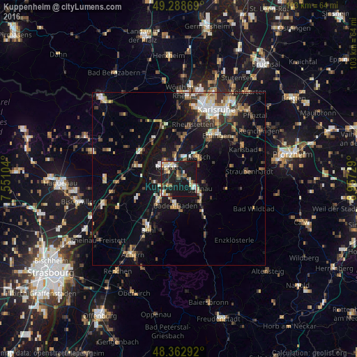
Analysis of Kuppenheim night lights 2016
Square area 10x10 km:
 4.12%
4.12%90-99
5.54%80-89
3.69%70-79
5.4%60-69
2.84%50-59
3.41%40-49
1.99%30-39
3.41%20-29
8.24%10-19
60.94%0-9
0.43%Square area 50x50 km:
1.58%90-99
2.06%80-89
1.28%70-79
1.55%60-69
1.5%50-59
2%40-49
1.93%30-39
2.29%20-29
2.92%10-19
11.03%0-9
71.87%Clear (daylight) street map image can be seen on geolist.org.
Map coordinates:
49° 17' 19.3" North, 7° 33' 3.7" East
48° 49' 40.6" North, 8° 15' 15" East
48° 21' 46.5" North, 8° 57' 26.2" East
Some cities around Kuppenheim sort by population:
• Baden-Baden
7.6 km =4.7 mi,  188°
188°
• Rastatt
4.7 km =2.9 mi,  316°
316°
• Gaggenau
6.6 km =4.1 mi,  118°
118°
• Gernsbach
9.1 km =5.7 mi,  134°
134°
• Malsch
8.5 km =5.3 mi,  43°
43°
• Rheinau
6.7 km =4.2 mi, 316°
• Muggensturm
4.8 km =3 mi,  26°
26°
• Bietigheim
9 km =5.6 mi,  359°
359°
2882375 (p: 7,533)
Sources (retrieved 2019-11-25):
» Earth at Night: Flat Maps 2012, 2016