Bühl night lights from space
Night Light of Bühl (Baden-Württemberg) from space (Germany) Src. Average luminocity for 10x10km area is 13.9792% and for 50x50km: 11.7494%.
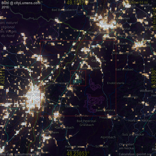
Analysis of Bühl night lights 2016
Square area 10x10 km:
 0.74%
0.74%90-99
1.64%80-89
2.23%70-79
0.74%60-69
1.64%50-59
0.74%40-49
1.79%30-39
2.08%20-29
5.06%10-19
9.82%0-9
73.51%Square area 50x50 km:
1.36%90-99
1.52%80-89
1.02%70-79
1.31%60-69
1.2%50-59
1.54%40-49
1.53%30-39
1.62%20-29
2.5%10-19
13.78%0-9
72.61%Clear (daylight) street map image can be seen on geolist.org.
Map coordinates:
49° 9' 31.4" North, 7° 25' 55.6" East
48° 41' 48.3" North, 8° 8' 6.8" East
48° 13' 49.9" North, 8° 50' 18.1" East
Some cities around Bühl sort by population:
• Baden-Baden
10.4 km =6.5 mi,  47°
47°
• Achern
8.5 km =5.3 mi,  210°
210°
• Sinzheim
8.1 km =5 mi,  16°
16°
• Bühlertal
4.1 km =2.5 mi,  107°
107°
• Zell
5.3 km =3.3 mi,  264°
264°
• Ottersweier
3.4 km =2.1 mi, 208°
• Sasbach
7 km =4.3 mi, 205°
• Lichtenau
10.1 km =6.3 mi,  288°
288°
2941976 (p: 29,193)
Sources (retrieved 2019-11-25):
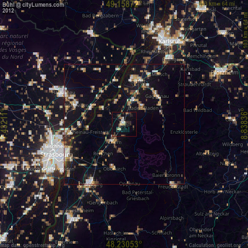
» Earth at Night: Flat Maps 2012, 2016