Sendenhorst night lights from space
Night Light of Sendenhorst (North Rhine-Westphalia) from space (Germany) Src. Average luminocity for 10x10km area is 1.7227% and for 50x50km: 8.1218%.
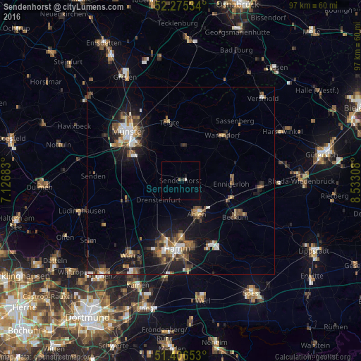
Analysis of Sendenhorst night lights 2016
Square area 10x10 km:
 0.28%
0.28%90-99
0.28%80-89
0%70-79
0%60-69
0.56%50-59
0%40-49
0.28%30-39
0.28%20-29
0%10-19
1.12%0-9
97.2%Square area 50x50 km:
0.96%90-99
1.19%80-89
0.49%70-79
0.67%60-69
1.29%50-59
1.36%40-49
1.59%30-39
1.51%20-29
1.79%10-19
7.14%0-9
82.01%Clear (daylight) street map image can be seen on geolist.org.
Map coordinates:
52° 16' 31.2" North, 7° 7' 36.6" East
51° 50' 34.9" North, 7° 49' 47.9" East
51° 24' 23.5" North, 8° 31' 59.1" East
Some cities around Sendenhorst sort by population:
• Ahlen
9.7 km =6 mi,  155°
155°
• Warendorf
16.2 km =10.1 mi,  41°
41°
• Beckum
17.4 km =10.8 mi,  123°
123°
• Ennigerloh
13.8 km =8.6 mi,  92°
92°
• Telgte
15.6 km =9.7 mi,  348°
348°
• Drensteinfurt
8.2 km =5.1 mi,  229°
229°
• Ascheberg
16.1 km =10 mi,  245°
245°
• Everswinkel
9.3 km =5.8 mi,  7°
7°
2833076 (p: 13,316)
Sources (retrieved 2019-11-25):
» Earth at Night: Flat Maps 2012, 2016