Runkel night lights from space
Night Light of Runkel (Hesse) from space (Germany) Src. Average luminocity for 10x10km area is 5.7115% and for 50x50km: 2.9133%.
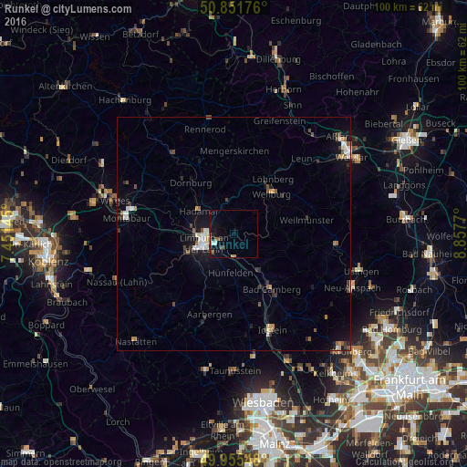
Analysis of Runkel night lights 2016
Square area 10x10 km:
 0.56%
0.56%90-99
0.56%80-89
0%70-79
0.28%60-69
0.84%50-59
1.68%40-49
0.56%30-39
0.84%20-29
0.84%10-19
7.84%0-9
85.99%Square area 50x50 km:
0.37%90-99
0.47%80-89
0.18%70-79
0.29%60-69
0.27%50-59
0.47%40-49
0.38%30-39
0.5%20-29
0.46%10-19
2.1%0-9
94.51%Clear (daylight) street map image can be seen on geolist.org.
Map coordinates:
50° 51' 6.3" North, 7° 27' 5.2" East
50° 24' 20.7" North, 8° 9' 16.5" East
49° 57' 19.7" North, 8° 51' 27.7" East
Some cities around Runkel sort by population:
• Limburg an der Lahn
7.8 km =4.8 mi,  251°
251°
• Bad Camberg
14.6 km =9.1 mi,  146°
146°
• Weilburg
11.6 km =7.2 mi,  41°
41°
• Hadamar
9.1 km =5.7 mi,  299°
299°
• Diez
11 km =6.8 mi, 251°
• Elz
8.7 km =5.4 mi,  278°
278°
• Villmar
3.1 km =1.9 mi,  117°
117°
• Waldbrunn
13 km =8.1 mi,  345°
345°
2843042 (p: 9,872)
Sources (retrieved 2019-11-25):
» Earth at Night: Flat Maps 2012, 2016