Weilburg night lights from space
Night Light of Weilburg (Hesse) from space (Germany) Src. Average luminocity for 10x10km area is 2.5644% and for 50x50km: 2.758%.
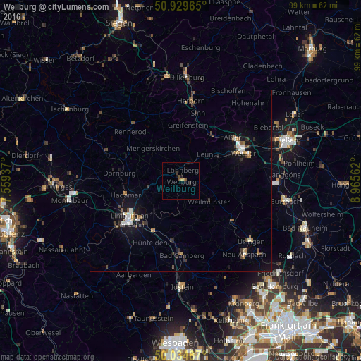
Analysis of Weilburg night lights 2016
Square area 10x10 km:
 0%
0%90-99
0%80-89
0%70-79
1.12%60-69
0%50-59
1.26%40-49
0.42%30-39
0.84%20-29
0.56%10-19
0.84%0-9
94.96%Square area 50x50 km:
0.29%90-99
0.41%80-89
0.17%70-79
0.28%60-69
0.3%50-59
0.46%40-49
0.43%30-39
0.45%20-29
0.34%10-19
2.24%0-9
94.62%Clear (daylight) street map image can be seen on geolist.org.
Map coordinates:
50° 55' 46.7" North, 7° 33' 33.7" East
50° 29' 3.8" North, 8° 15' 45" East
50° 2' 5.5" North, 8° 57' 56.2" East
Some cities around Weilburg sort by population:
• Braunfels
9.6 km =6 mi,  68°
68°
• Runkel
11.6 km =7.2 mi,  221°
221°
• Weilmünster
10 km =6.2 mi,  126°
126°
• Selters
4.1 km =2.5 mi,  27°
27°
• Villmar
11.3 km =7 mi,  205°
205°
• Waldbrunn
11.6 km =7.2 mi,  289°
289°
• Mengerskirchen
11.6 km =7.2 mi,  319°
319°
• Leun
10.1 km =6.3 mi,  42°
42°
2812626 (p: 13,798)
Sources (retrieved 2019-11-25):
» Earth at Night: Flat Maps 2012, 2016