Rimbach night lights from space
Night Light of Rimbach (Hesse) from space (Germany) Src. Average luminocity for 10x10km area is 0.6148% and for 50x50km: 14.0041%.
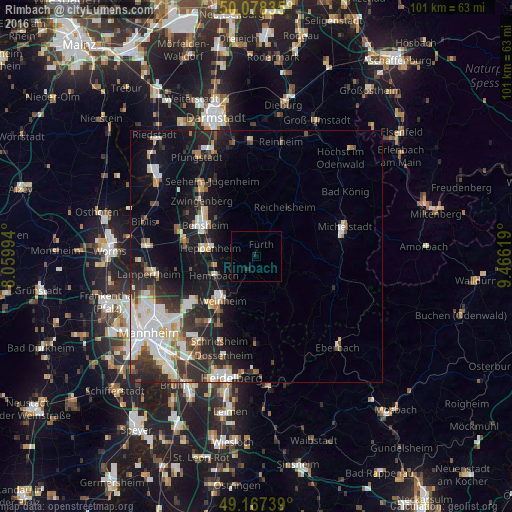
Analysis of Rimbach night lights 2016
Square area 10x10 km:
 0%
0%90-99
0%80-89
0%70-79
0%60-69
0%50-59
0%40-49
0%30-39
0%20-29
1.4%10-19
0.28%0-9
98.32%Square area 50x50 km:
2.95%90-99
3.16%80-89
1.22%70-79
1.19%60-69
1.06%50-59
1.45%40-49
1.44%30-39
2.01%20-29
4.62%10-19
9.24%0-9
71.66%Clear (daylight) street map image can be seen on geolist.org.
Map coordinates:
50° 4' 42.1" North, 8° 3' 35.8" East
49° 37' 30" North, 8° 45' 47" East
49° 10' 2.6" North, 9° 27' 58.3" East
Some cities around Rimbach sort by population:
• Heppenheim an der Bergstrasse
9.6 km =6 mi,  280°
280°
• Hemsbach
9.1 km =5.7 mi,  245°
245°
• Wald-Michelbach
7.9 km =4.9 mi,  141°
141°
• Fürth
3.3 km =2.1 mi,  28°
28°
• Mörlenbach
3.5 km =2.2 mi,  215°
215°
• Birkenau
8 km =5 mi,  210°
210°
• Laudenbach
8 km =5 mi,  260°
260°
• Lindenfels
6.7 km =4.2 mi,  11°
11°
2846754 (p: 8,537)
Sources (retrieved 2019-11-25):
» Earth at Night: Flat Maps 2012, 2016