Kaiserslautern night lights from space
Night Light of Kaiserslautern (Rheinland-Pfalz) from space (Germany) Src. Average luminocity for 10x10km area is 35.3417% and for 50x50km: 5.3353%.
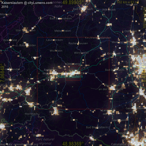
Analysis of Kaiserslautern night lights 2016
Square area 10x10 km:
 6.86%
6.86%90-99
8.96%80-89
3.92%70-79
2.66%60-69
3.5%50-59
1.26%40-49
1.96%30-39
2.94%20-29
8.26%10-19
48.88%0-9
10.78%Square area 50x50 km:
0.6%90-99
0.82%80-89
0.61%70-79
0.35%60-69
0.57%50-59
0.54%40-49
0.9%30-39
0.75%20-29
1.17%10-19
5.8%0-9
87.89%Clear (daylight) street map image can be seen on geolist.org.
Map coordinates:
49° 53' 53" North, 7° 4' 6.6" East
49° 26' 34.8" North, 7° 46' 17.8" East
48° 59' 1.3" North, 8° 28' 29.1" East
Some cities around Kaiserslautern sort by population:
• Eisenberg
25.2 km =15.7 mi,  59°
59°
• Landstuhl
14.9 km =9.3 mi,  257°
257°
• Ramstein-Miesenbach
15.6 km =9.7 mi,  270°
270°
• Rodalben
24.6 km =15.3 mi,  202°
202°
• Enkenbach-Alsenborn
10.3 km =6.4 mi, 64°
• Rockenhausen
21.1 km =13.1 mi,  9°
9°
• Otterberg
6.7 km =4.2 mi,  358°
358°
• Waldfischbach-Burgalben
19.3 km =12 mi, 203°
2894003 (p: 98,732)
Sources (retrieved 2019-11-25):
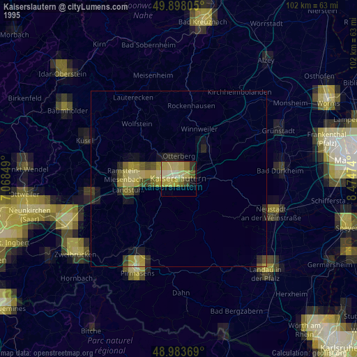
» NASA, Earths city lights 1995
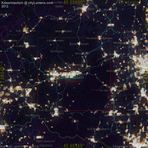
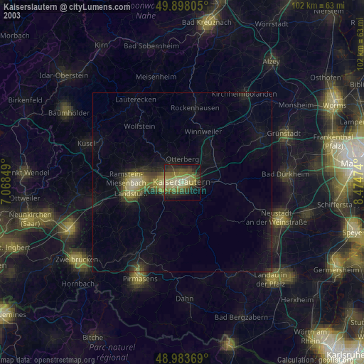
» NASA city lights 2003
» Earth at Night: Flat Maps 2012, 2016