Prien am Chiemsee night lights from space
Night Light of Prien am Chiemsee (Bavaria) from space (Germany) Src. Average luminocity for 10x10km area is 3% and for 50x50km: 2.4947%.
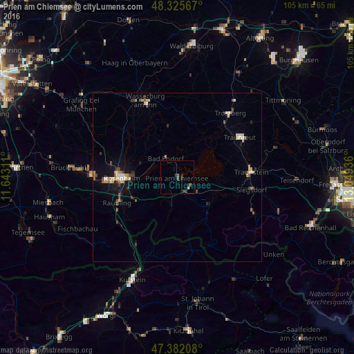
Analysis of Prien am Chiemsee night lights 2016
Square area 10x10 km:
 0.14%
0.14%90-99
0.43%80-89
0%70-79
0%60-69
0%50-59
1.14%40-49
0.57%30-39
1.99%20-29
1.42%10-19
0.85%0-9
93.47%Square area 50x50 km:
0.21%90-99
0.31%80-89
0.35%70-79
0.36%60-69
0.27%50-59
0.35%40-49
0.31%30-39
0.46%20-29
0.31%10-19
1.58%0-9
95.48%Clear (daylight) street map image can be seen on geolist.org.
Map coordinates:
48° 19' 32.4" North, 11° 38' 35.2" East
47° 51' 21.7" North, 12° 20' 46.4" East
47° 22' 55.5" North, 13° 2' 57.7" East
Some cities around Prien am Chiemsee sort by population:
• Rosenheim
16.7 km =10.4 mi,  270°
270°
• Stephanskirchen
12 km =7.5 mi, 268°
• Bad Endorf
6.9 km =4.3 mi,  328°
328°
• Bernau am Chiemsee
5.4 km =3.4 mi,  155°
155°
• Grassau
11.6 km =7.2 mi,  136°
136°
• Rohrdorf
14.7 km =9.1 mi,  243°
243°
• Aschau im Chiemgau
9 km =5.6 mi,  191°
191°
• Riedering
10.5 km =6.5 mi,  259°
259°
2852101 (p: 10,060)
Sources (retrieved 2019-11-25):
» Earth at Night: Flat Maps 2012, 2016