Bad Endorf night lights from space
Night Light of Bad Endorf (Bavaria) from space (Germany) Src. Average luminocity for 10x10km area is 0.5838% and for 50x50km: 2.5648%.
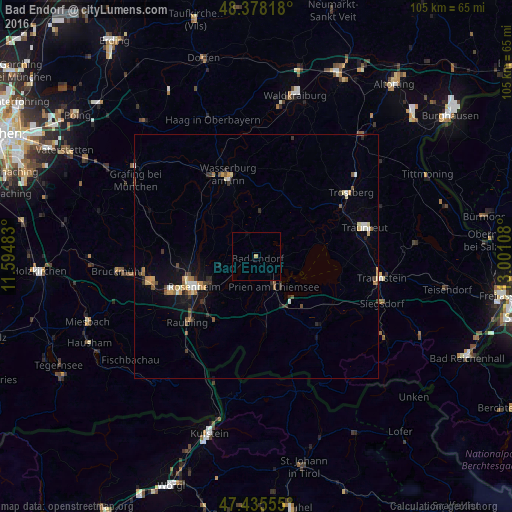
Analysis of Bad Endorf night lights 2016
Square area 10x10 km:
 0%
0%90-99
0%80-89
0%70-79
0.57%60-69
0%50-59
0%40-49
0%30-39
0%20-29
0%10-19
0%0-9
99.43%Square area 50x50 km:
0.19%90-99
0.32%80-89
0.34%70-79
0.39%60-69
0.28%50-59
0.38%40-49
0.33%30-39
0.49%20-29
0.34%10-19
1.6%0-9
95.33%Clear (daylight) street map image can be seen on geolist.org.
Map coordinates:
48° 22' 41.4" North, 11° 35' 41.4" East
47° 54' 32.4" North, 12° 17' 52.6" East
47° 26' 8" North, 13° 0' 3.9" East
Some cities around Bad Endorf sort by population:
• Rosenheim
14.3 km =8.9 mi,  245°
245°
• Prien am Chiemsee
6.9 km =4.3 mi,  148°
148°
• Stephanskirchen
10.4 km =6.5 mi,  233°
233°
• Großkarolinenfeld
16.3 km =10.1 mi,  262°
262°
• Bernau am Chiemsee
12.3 km =7.6 mi, 151°
• Rohrdorf
15.7 km =9.8 mi,  217°
217°
• Aschau im Chiemgau
14.8 km =9.2 mi,  172°
172°
• Riedering
10.3 km =6.4 mi, 220°
2930367 (p: 7,465)
Sources (retrieved 2019-11-25):
» Earth at Night: Flat Maps 2012, 2016