Bernau am Chiemsee night lights from space
Night Light of Bernau am Chiemsee (Bavaria) from space (Germany) Src. Average luminocity for 10x10km area is 2.7277% and for 50x50km: 2.3135%.
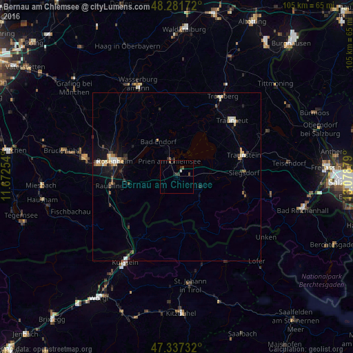
Analysis of Bernau am Chiemsee night lights 2016
Square area 10x10 km:
 0.15%
0.15%90-99
0.45%80-89
0%70-79
0%60-69
0%50-59
0.74%40-49
1.04%30-39
1.93%20-29
0.45%10-19
0.89%0-9
94.35%Square area 50x50 km:
0.24%90-99
0.29%80-89
0.29%70-79
0.29%60-69
0.24%50-59
0.31%40-49
0.31%30-39
0.4%20-29
0.33%10-19
1.54%0-9
95.76%Clear (daylight) street map image can be seen on geolist.org.
Map coordinates:
48° 16' 54.2" North, 11° 40' 21.1" East
47° 48' 42" North, 12° 22' 32.4" East
47° 20' 14.4" North, 13° 4' 43.6" East
Some cities around Bernau am Chiemsee sort by population:
• Rosenheim
19.5 km =12.1 mi,  284°
284°
• Prien am Chiemsee
5.4 km =3.4 mi,  335°
335°
• Stephanskirchen
14.9 km =9.3 mi,  288°
288°
• Bad Endorf
12.3 km =7.6 mi,  331°
331°
• Grassau
6.7 km =4.2 mi,  120°
120°
• Rohrdorf
15.4 km =9.6 mi,  263°
263°
• Aschau im Chiemgau
5.5 km =3.4 mi,  225°
225°
• Riedering
12.9 km =8 mi, 283°
2950095 (p: 6,645)
Sources (retrieved 2019-11-25):
» Earth at Night: Flat Maps 2012, 2016