Potsdam night lights from space
Night Light of Potsdam (Brandenburg) from space (Germany) Src. Average luminocity for 10x10km area is 52.2235% and for 50x50km: 23.1402%.
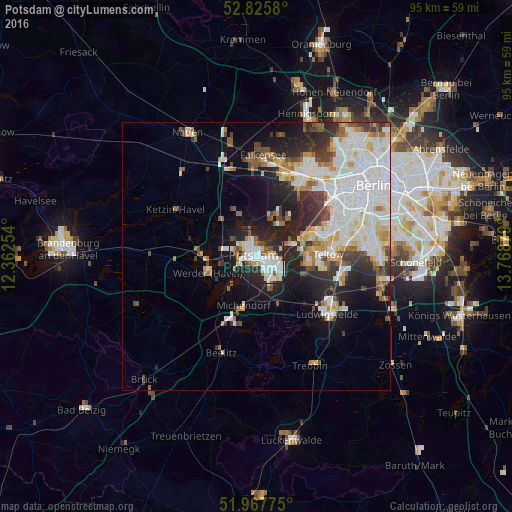
Analysis of Potsdam night lights 2016
Square area 10x10 km:
 14.77%
90-99
13.51%80-89
5.18%70-79
2.78%60-69
5.43%50-59
4.04%40-49
3.79%30-39
2.4%20-29
28.03%10-19
19.82%0-9
0.25%Square area 50x50 km:
7%90-99
5.77%80-89
2.22%70-79
1.7%60-69
1.89%50-59
2.08%40-49
2.28%30-39
2.46%20-29
5.51%10-19
7.69%0-9
61.4%Clear (daylight) street map image can be seen on geolist.org.
Map coordinates:
52° 49' 32.9" North, 12° 21' 45.1" East
52° 23' 55.9" North, 13° 3' 56.4" East
51° 58' 3.9" North, 13° 46' 7.6" East
Some cities around Potsdam sort by population:
• Zehlendorf
13.1 km =8.1 mi,  72°
72°
• Werder
9.2 km =5.7 mi,  255°
255°
• Kleinmachnow
10.9 km =6.8 mi,  84°
84°
• Nikolassee
10 km =6.2 mi, 66°
• Kladow
8.2 km =5.1 mi,  40°
40°
• Stahnsdorf
10.4 km =6.5 mi,  99°
99°
• Michendorf
9.8 km =6.1 mi,  194°
194°
• Wannsee
6.5 km =4 mi, 69°
2852458 (p: 145,292)
Sources (retrieved 2019-11-25):
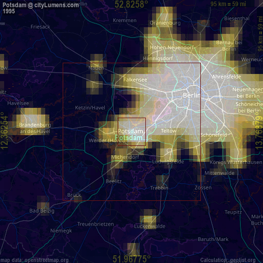
» NASA, Earths city lights 1995
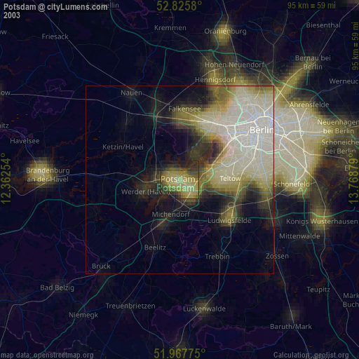
» NASA city lights 2003
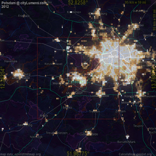
» Earth at Night: Flat Maps 2012, 2016