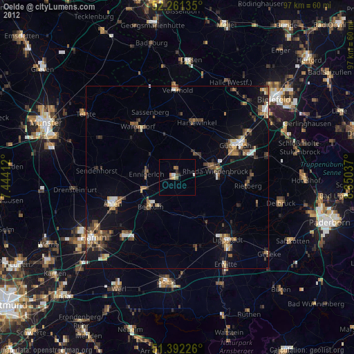
Oelde night lights from space
Night Light of Oelde (North Rhine-Westphalia) from space (Germany) Src. Average luminocity for 10x10km area is 3.3739% and for 50x50km: 6.6298%.
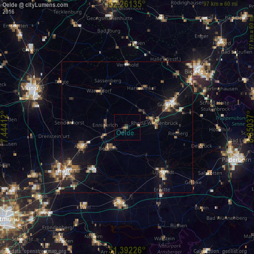
Analysis of Oelde night lights 2016
Square area 10x10 km:
 0.42%
0.42%90-99
0.14%80-89
0%70-79
0%60-69
0.56%50-59
1.4%40-49
0.28%30-39
0.56%20-29
1.68%10-19
2.24%0-9
92.72%Square area 50x50 km:
0.61%90-99
0.76%80-89
0.51%70-79
0.52%60-69
1.13%50-59
1.26%40-49
1.44%30-39
0.93%20-29
1.29%10-19
5.17%0-9
86.38%Clear (daylight) street map image can be seen on geolist.org.
Map coordinates:
52° 15' 40.9" North, 7° 26' 38.8" East
51° 49' 44" North, 8° 8' 50.1" East
51° 23' 32.1" North, 8° 51' 1.3" East
Some cities around Oelde sort by population:
• Rheda-Wiedenbrück
10.8 km =6.7 mi,  77°
77°
• Warendorf
17.5 km =10.9 mi,  321°
321°
• Beckum
10.9 km =6.8 mi,  221°
221°
• Harsewinkel
15.8 km =9.8 mi,  20°
20°
• Ennigerloh
8.1 km =5 mi,  277°
277°
• Wadersloh
12.8 km =8 mi,  146°
146°
• Langenberg
13.3 km =8.3 mi,  118°
118°
• Beelen
11.4 km =7.1 mi,  347°
347°
2857943 (p: 29,297)
Sources (retrieved 2019-11-25):
» Earth at Night: Flat Maps 2012, 2016