Oberding night lights from space
Night Light of Oberding (Bavaria) from space (Germany) Src. Average luminocity for 10x10km area is 19.2401% and for 50x50km: 13.5738%.
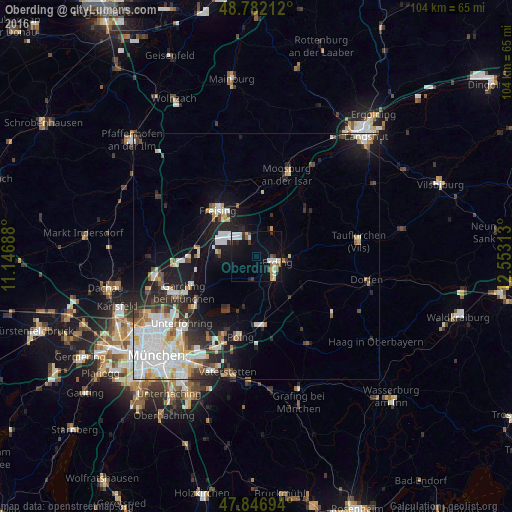
Analysis of Oberding night lights 2016
Square area 10x10 km:
 2.98%
2.98%90-99
5.26%80-89
1.56%70-79
1.85%60-69
0.85%50-59
1.7%40-49
2.41%30-39
1.99%20-29
2.13%10-19
10.23%0-9
69.03%Square area 50x50 km:
3.52%90-99
3.2%80-89
1.19%70-79
1.26%60-69
1.1%50-59
1.04%40-49
1.14%30-39
1.65%20-29
3.18%10-19
7.04%0-9
75.68%Clear (daylight) street map image can be seen on geolist.org.
Map coordinates:
48° 46' 55.6" North, 11° 8' 48.8" East
48° 19' 0" North, 11° 51' 0" East
47° 50' 49" North, 12° 33' 11.3" East
Some cities around Oberding sort by population:
• Freising
12.2 km =7.6 mi,  322°
322°
• Erding
4.4 km =2.7 mi,  105°
105°
• Neufahrn bei Freising
13.8 km =8.6 mi,  269°
269°
• Ismaning
15.4 km =9.6 mi,  233°
233°
• Poing
16.5 km =10.3 mi,  188°
188°
• Markt Schwaben
14.2 km =8.8 mi,  174°
174°
• Hallbergmoos
7.4 km =4.6 mi,  279°
279°
• Moosinning
4.4 km =2.7 mi, 185°
2861096 (p: 5,101)
Sources (retrieved 2019-11-25):
» Earth at Night: Flat Maps 2012, 2016