Neunkirchen am Main night lights from space
Night Light of Neunkirchen am Main (Bavaria) from space (Germany) Src. Average luminocity for 10x10km area is 10.2101% and for 50x50km: 1.8818%.
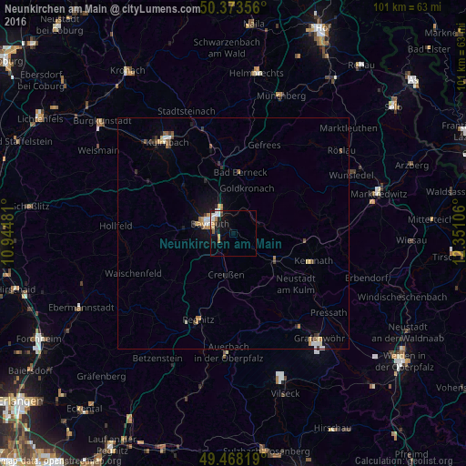
Analysis of Neunkirchen am Main night lights 2016
Square area 10x10 km:
 2.38%
2.38%90-99
1.68%80-89
0.98%70-79
1.68%60-69
1.12%50-59
0.84%40-49
0.56%30-39
0.56%20-29
0.7%10-19
8.54%0-9
80.95%Square area 50x50 km:
0.25%90-99
0.24%80-89
0.16%70-79
0.31%60-69
0.28%50-59
0.15%40-49
0.27%30-39
0.33%20-29
0.18%10-19
1.05%0-9
96.77%Clear (daylight) street map image can be seen on geolist.org.
Map coordinates:
50° 22' 24.8" North, 10° 56' 41.3" East
49° 55' 22.8" North, 11° 38' 52.5" East
49° 28' 5.5" North, 12° 21' 3.8" East
Some cities around Neunkirchen am Main sort by population:
• Bayreuth
5.7 km =3.5 mi,  299°
299°
• Kulmbach
24.3 km =15.1 mi,  324°
324°
• Pegnitz
20.5 km =12.7 mi,  201°
201°
• Bindlach
7 km =4.3 mi,  339°
339°
• Speichersdorf
11.1 km =6.9 mi,  121°
121°
• Pottenstein
24.1 km =15 mi,  225°
225°
• Kemnath
18.4 km =11.4 mi,  108°
108°
• Eckersdorf
21.5 km =13.4 mi, 303°
2864422 (p: 7,784)
Sources (retrieved 2019-11-25):
» Earth at Night: Flat Maps 2012, 2016